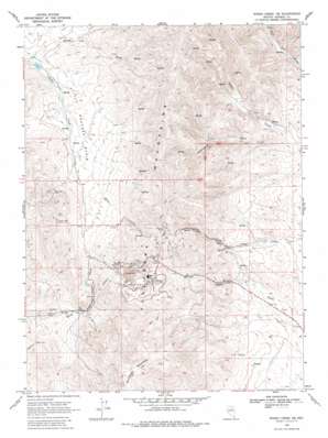
Rodeo Creek Ne Topo Map Nevada
To zoom in, hover over the map of Rodeo Creek Ne
USGS Topo Quad 40116h3 - 1:24,000 scale
| Topo Map Name: | Rodeo Creek Ne |
| USGS Topo Quad ID: | 40116h3 |
| Print Size: | ca. 21 1/4" wide x 27" high |
| Southeast Coordinates: | 40.875° N latitude / 116.25° W longitude |
| Map Center Coordinates: | 40.9375° N latitude / 116.3125° W longitude |
| U.S. State: | NV |
| Filename: | o40116h3.jpg |
| Download Map JPG Image: | Rodeo Creek Ne topo map 1:24,000 scale |
| Map Type: | Topographic |
| Topo Series: | 7.5´ |
| Map Scale: | 1:24,000 |
| Source of Map Images: | United States Geological Survey (USGS) |
| Alternate Map Versions: |
Rodeo Creek NE NV 1968, updated 1971 Download PDF Buy paper map Rodeo Creek NE NV 1968, updated 1981 Download PDF Buy paper map Rodeo Creek NE NV 2012 Download PDF Buy paper map Rodeo Creek NE NV 2014 Download PDF Buy paper map |
1:24,000 Topo Quads surrounding Rodeo Creek Ne
> Back to 40116e1 at 1:100,000 scale
> Back to 40116a1 at 1:250,000 scale
> Back to U.S. Topo Maps home
Rodeo Creek Ne topo map: Gazetteer
Rodeo Creek Ne: Basins
Little Boulder Basin elevation 1692m 5551′Rodeo Creek Ne: Dams
Carlin Mine Dam elevation 1824m 5984′Rodeo Reservoir Dam elevation 1628m 5341′
Rodeo Creek Ne: Mines
Big Six Mine elevation 2017m 6617′Blue Star Mine elevation 1858m 6095′
Carlin Mine elevation 1887m 6190′
Lynn Creek Placer Mines elevation 1809m 5935′
Newmont Mine elevation 2009m 6591′
Rodeo Creek Placer Mines elevation 1834m 6017′
Sheep Creek Placer Mines elevation 1729m 5672′
Rodeo Creek Ne: Populated Places
Goldville (historical) elevation 1862m 6108′Leeville elevation 1890m 6200′
Rodeo Creek Ne: Post Offices
Goldville Post Office (historical) elevation 1862m 6108′Rodeo Creek Ne: Streams
Brush Creek elevation 1629m 5344′Rodeo Creek Ne: Summits
Popovich Hill elevation 2003m 6571′Richmond Mountain elevation 2197m 7208′
Rodeo Creek Ne: Valleys
Sheep Creek Canyon elevation 1634m 5360′Simons Canyon elevation 1775m 5823′
Rodeo Creek Ne digital topo map on disk
Buy this Rodeo Creek Ne topo map showing relief, roads, GPS coordinates and other geographical features, as a high-resolution digital map file on DVD:


