Mount Moses Se Topo Map Nevada
To zoom in, hover over the map of Mount Moses Se
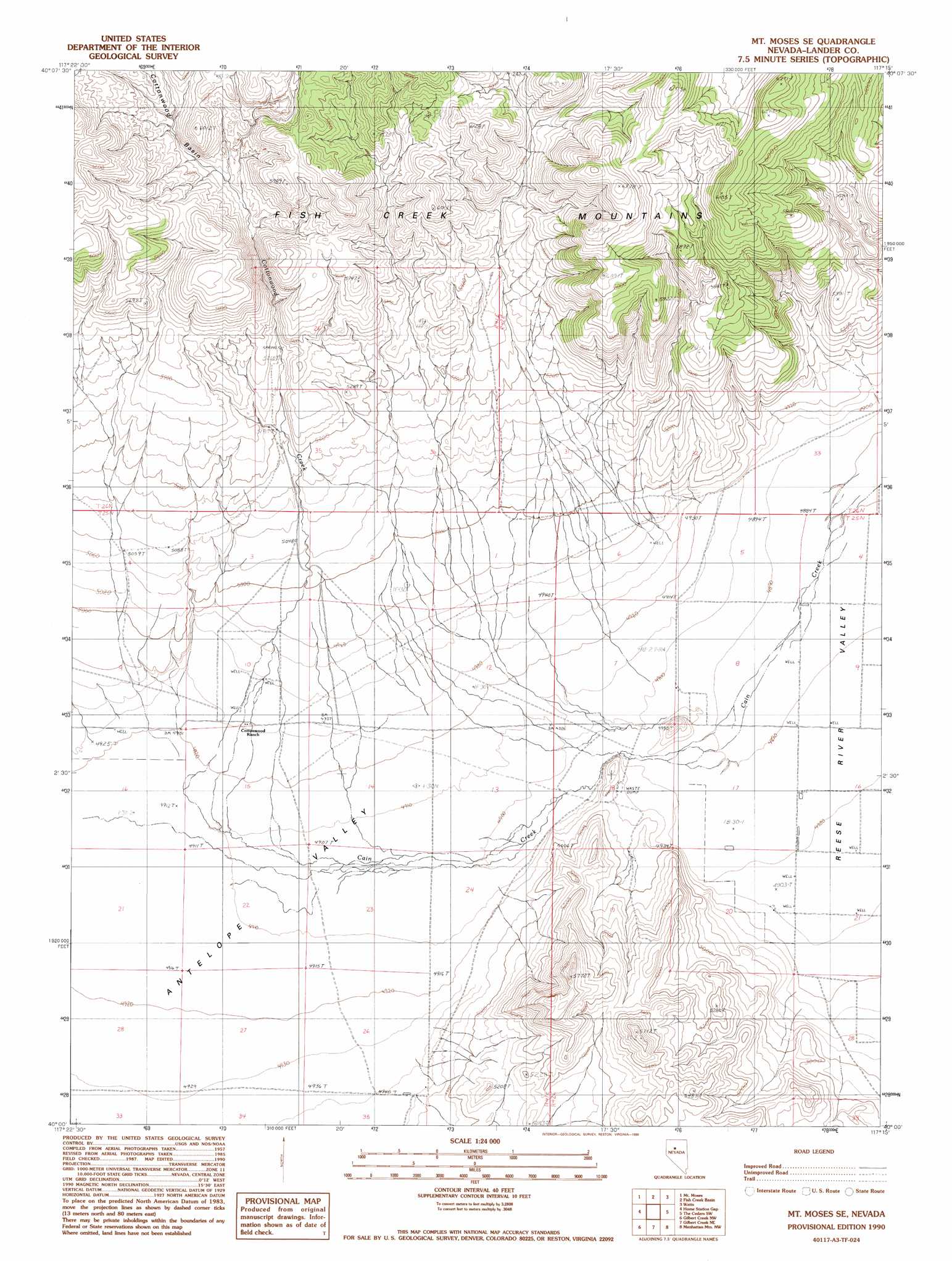
USGS Topo Quad 40117a3 - 1:24,000 scale
| Topo Map Name: | Mount Moses Se |
| USGS Topo Quad ID: | 40117a3 |
| Print Size: | ca. 21 1/4" wide x 27" high |
| Southeast Coordinates: | 40° N latitude / 117.25° W longitude |
| Map Center Coordinates: | 40.0625° N latitude / 117.3125° W longitude |
| U.S. State: | NV |
| Filename: | o40117a3.jpg |
| Download Map JPG Image: | Mount Moses Se topo map 1:24,000 scale |
| Map Type: | Topographic |
| Topo Series: | 7.5´ |
| Map Scale: | 1:24,000 |
| Source of Map Images: | United States Geological Survey (USGS) |
| Alternate Map Versions: |
Mt. Moses SE NV 1990, updated 1990 Download PDF Buy paper map Mount Moses SE NV 2011 Download PDF Buy paper map Mount Moses SE NV 2014 Download PDF Buy paper map |
1:24,000 Topo Quads surrounding Mount Moses Se
Needle Peak |
Jersey Summit |
Wild Range Canyon |
Mccoy |
Redrock Spring |
Home Station Ranch |
Mount Moses |
Fish Creek Basin |
Fish Creek Ranch |
Moss Creek |
Cain Mountain |
Home Station Gap |
Mount Moses Se |
The Cedars Sw |
The Cedars |
Shoshone Meadows Ne |
Gilbert Creek Nw |
Gilbert Creek Ne |
Manhattan Mountain Nw |
Manhattan Mountain Ne |
Shoshone Meadows Se |
Gilbert Creek Sw |
Gilbert Creek Se |
Manhattan Mountain |
Joe Eason Mountain |
> Back to 40117a1 at 1:100,000 scale
> Back to 40116a1 at 1:250,000 scale
> Back to U.S. Topo Maps home
Mount Moses Se digital topo map on disk
Buy this Mount Moses Se topo map showing relief, roads, GPS coordinates and other geographical features, as a high-resolution digital map file on DVD: