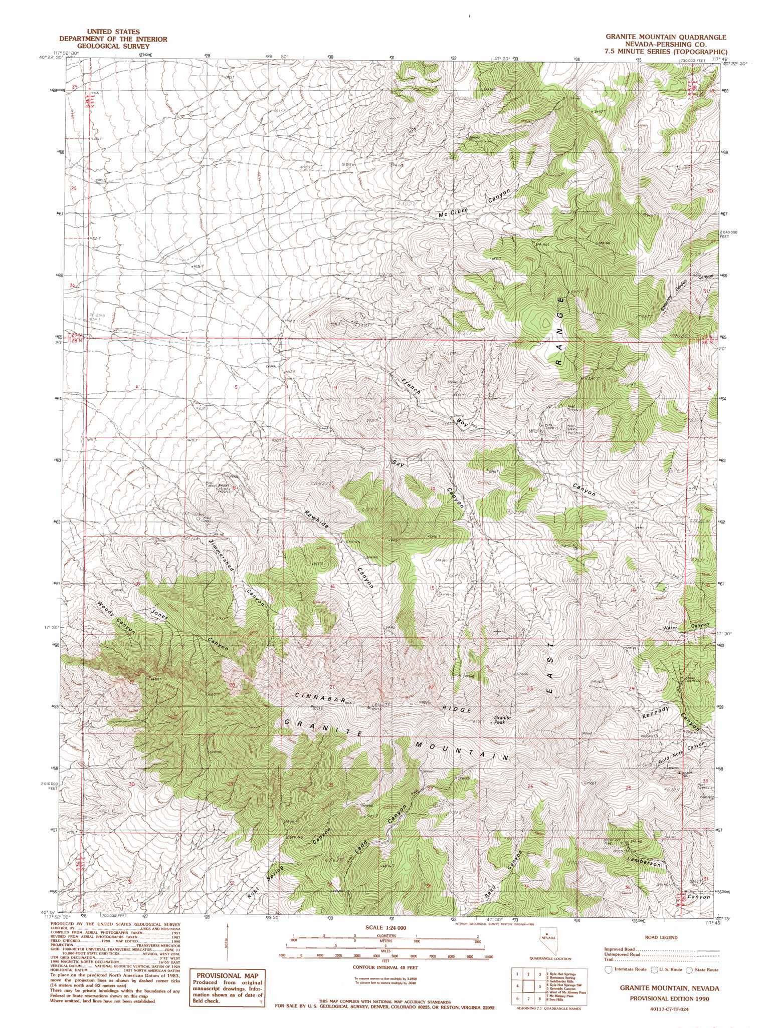
Granite Mountain Topo Map Nevada
To zoom in, hover over the map of Granite Mountain
USGS Topo Quad 40117c7 - 1:24,000 scale
| Topo Map Name: | Granite Mountain |
| USGS Topo Quad ID: | 40117c7 |
| Print Size: | ca. 21 1/4" wide x 27" high |
| Southeast Coordinates: | 40.25° N latitude / 117.75° W longitude |
| Map Center Coordinates: | 40.3125° N latitude / 117.8125° W longitude |
| U.S. State: | NV |
| Filename: | o40117c7.jpg |
| Download Map JPG Image: | Granite Mountain topo map 1:24,000 scale |
| Map Type: | Topographic |
| Topo Series: | 7.5´ |
| Map Scale: | 1:24,000 |
| Source of Map Images: | United States Geological Survey (USGS) |
| Alternate Map Versions: |
Granite Mountain NV 1990, updated 1990 Download PDF Buy paper map Granite Mountain NV 2011 Download PDF Buy paper map Granite Mountain NV 2015 Download PDF Buy paper map |
1:24,000 Topo Quads surrounding Granite Mountain
Star Creek Ranch |
Inskip Canyon |
Lee Peak |
Leach Hot Springs |
Panther Canyon |
Unionville |
Kyle Hot Springs |
Bartomes Spring |
Goldbanks Hills |
Mount Tobin |
Fitting |
Kyle Hot Springs Sw |
Granite Mountain |
Kennedy Canyon |
Needle Peak |
Fisher Canyon |
West Of Mckinney Pass |
Mckinney Pass |
Sou Hills |
Home Station Ranch |
Cornish Peak |
Logan Peak |
Fencemaker Pass |
Sou Hot Springs |
Cain Mountain |
> Back to 40117a1 at 1:100,000 scale
> Back to 40116a1 at 1:250,000 scale
> Back to U.S. Topo Maps home
Granite Mountain topo map: Gazetteer
Granite Mountain: Mines
Gold Note Mine elevation 1918m 6292′Henrietta Mine elevation 1851m 6072′
Granite Mountain: Ridges
Cinnabar Ridge elevation 2498m 8195′Granite Mountain: Summits
Granite Mountain elevation 2551m 8369′Granite Peak elevation 2540m 8333′
Granite Mountain: Valleys
French Boy Canyon elevation 1464m 4803′Gold Note Canyon elevation 1691m 5547′
Jones Canyon elevation 1404m 4606′
McClure Canyon elevation 1517m 4977′
Rawhide Canyon elevation 1465m 4806′
Say Canyon elevation 1466m 4809′
Zimmershed Canyon elevation 1354m 4442′
Granite Mountain digital topo map on disk
Buy this Granite Mountain topo map showing relief, roads, GPS coordinates and other geographical features, as a high-resolution digital map file on DVD: