Mccoy Nw Topo Map Nevada
To zoom in, hover over the map of Mccoy Nw
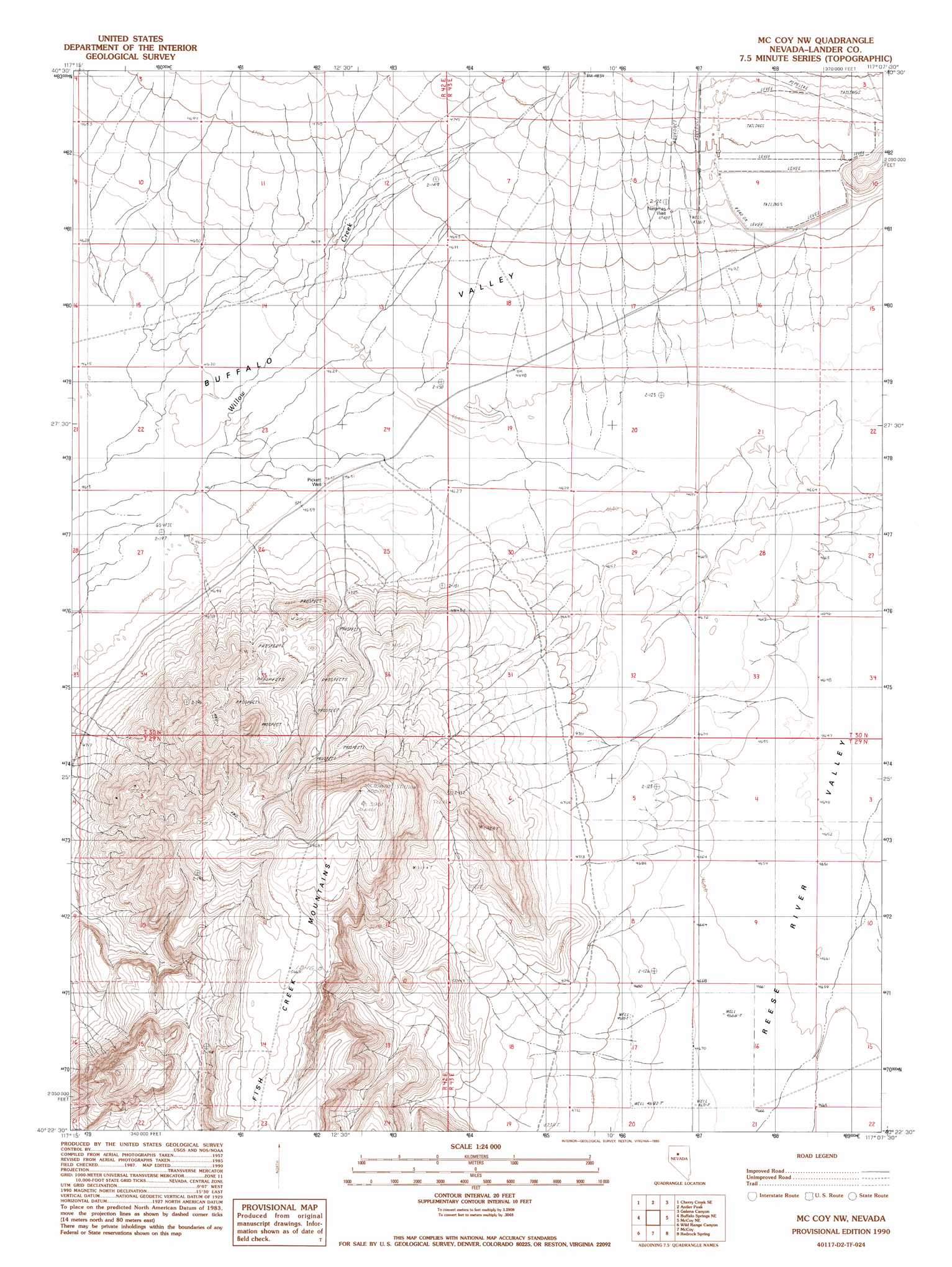
USGS Topo Quad 40117d2 - 1:24,000 scale
| Topo Map Name: | Mccoy Nw |
| USGS Topo Quad ID: | 40117d2 |
| Print Size: | ca. 21 1/4" wide x 27" high |
| Southeast Coordinates: | 40.375° N latitude / 117.125° W longitude |
| Map Center Coordinates: | 40.4375° N latitude / 117.1875° W longitude |
| U.S. State: | NV |
| Filename: | o40117d2.jpg |
| Download Map JPG Image: | Mccoy Nw topo map 1:24,000 scale |
| Map Type: | Topographic |
| Topo Series: | 7.5´ |
| Map Scale: | 1:24,000 |
| Source of Map Images: | United States Geological Survey (USGS) |
| Alternate Map Versions: |
McCoy NW NV 1990, updated 1990 Download PDF Buy paper map McCoy NW NV 2011 Download PDF Buy paper map McCoy NW NV 2014 Download PDF Buy paper map |
1:24,000 Topo Quads surrounding Mccoy Nw
Smelser Pass |
China Mountain Ne |
North Peak |
Snow Gulch |
Battle Mountain |
China Mountain |
China Mountain Se |
Antler Peak |
Galena |
Blossom Spring |
Buffalo Springs |
Buffalo Springs Ne |
Mccoy Nw |
Mccoy Ne |
Crippen Canyon |
Jersey Summit |
Wild Range Canyon |
Mccoy |
Redrock Spring |
Goat Peak |
Mount Moses |
Fish Creek Basin |
Fish Creek Ranch |
Moss Creek |
Carico Lake North |
> Back to 40117a1 at 1:100,000 scale
> Back to 40116a1 at 1:250,000 scale
> Back to U.S. Topo Maps home
Mccoy Nw topo map: Gazetteer
Mccoy Nw: Dams
Copper Canyon Mill Dam elevation 1458m 4783′Mccoy Nw: Streams
Rock Creek elevation 1408m 4619′Mccoy Nw: Wells
Natomas Well elevation 1446m 4744′Pickett Well elevation 1412m 4632′
Mccoy Nw digital topo map on disk
Buy this Mccoy Nw topo map showing relief, roads, GPS coordinates and other geographical features, as a high-resolution digital map file on DVD: