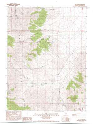
Lee Peak Topo Map Nevada
To zoom in, hover over the map of Lee Peak
USGS Topo Quad 40117e7 - 1:24,000 scale
| Topo Map Name: | Lee Peak |
| USGS Topo Quad ID: | 40117e7 |
| Print Size: | ca. 21 1/4" wide x 27" high |
| Southeast Coordinates: | 40.5° N latitude / 117.75° W longitude |
| Map Center Coordinates: | 40.5625° N latitude / 117.8125° W longitude |
| U.S. State: | NV |
| Filename: | o40117e7.jpg |
| Download Map JPG Image: | Lee Peak topo map 1:24,000 scale |
| Map Type: | Topographic |
| Topo Series: | 7.5´ |
| Map Scale: | 1:24,000 |
| Source of Map Images: | United States Geological Survey (USGS) |
| Alternate Map Versions: |
Lee Peak NV 1990, updated 1990 Download PDF Buy paper map Lee Peak NV 2011 Download PDF Buy paper map Lee Peak NV 2014 Download PDF Buy paper map |
1:24,000 Topo Quads surrounding Lee Peak
> Back to 40117e1 at 1:100,000 scale
> Back to 40116a1 at 1:250,000 scale
> Back to U.S. Topo Maps home
Lee Peak topo map: Gazetteer
Lee Peak: Gaps
Klondike Pass elevation 1849m 6066′Lee Peak: Mines
Spaulding Canyon Mines elevation 1683m 5521′Yellowstone Mine elevation 1844m 6049′
Lee Peak: Springs
Mud Springs elevation 1511m 4957′Rawhide Spring elevation 1901m 6236′
Yellowstone Spring elevation 1674m 5492′
Lee Peak: Streams
Lees Creek elevation 1475m 4839′Marble Creek elevation 1534m 5032′
Spauldings Creek elevation 1538m 5045′
Lee Peak: Summits
Lee Peak elevation 2197m 7208′Table Mountain elevation 2250m 7381′
Lee Peak: Valleys
Highrock Canyon elevation 1490m 4888′Lee Canyon elevation 1502m 4927′
Rawhide Canyon elevation 1516m 4973′
Spaulding Canyon elevation 1496m 4908′
Yellowstone Canyon elevation 1524m 5000′
Lee Peak digital topo map on disk
Buy this Lee Peak topo map showing relief, roads, GPS coordinates and other geographical features, as a high-resolution digital map file on DVD:


