Valmy Topo Map Nevada
To zoom in, hover over the map of Valmy
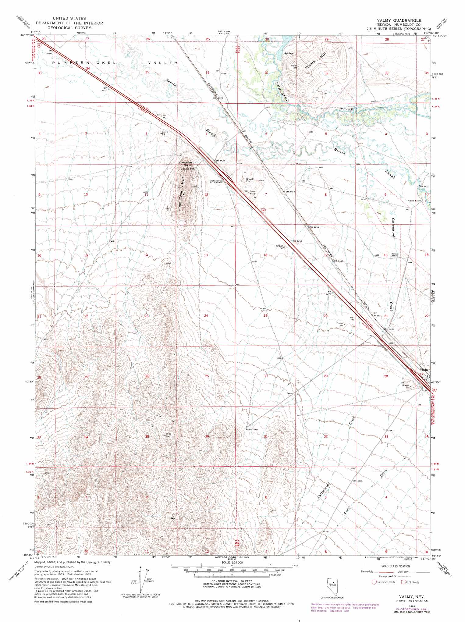
USGS Topo Quad 40117g2 - 1:24,000 scale
| Topo Map Name: | Valmy |
| USGS Topo Quad ID: | 40117g2 |
| Print Size: | ca. 21 1/4" wide x 27" high |
| Southeast Coordinates: | 40.75° N latitude / 117.125° W longitude |
| Map Center Coordinates: | 40.8125° N latitude / 117.1875° W longitude |
| U.S. State: | NV |
| Filename: | o40117g2.jpg |
| Download Map JPG Image: | Valmy topo map 1:24,000 scale |
| Map Type: | Topographic |
| Topo Series: | 7.5´ |
| Map Scale: | 1:24,000 |
| Source of Map Images: | United States Geological Survey (USGS) |
| Alternate Map Versions: |
Valmy NV 1965, updated 1967 Download PDF Buy paper map Valmy NV 1965, updated 1981 Download PDF Buy paper map Valmy NV 1965, updated 1981 Download PDF Buy paper map Valmy NV 2011 Download PDF Buy paper map Valmy NV 2014 Download PDF Buy paper map |
1:24,000 Topo Quads surrounding Valmy
Anderson Gardens |
Red House Flat West |
Red House Flat East |
Elevenmile Well |
Midas Sw |
Golconda |
Iron Point |
Knight |
Hot Pot |
Izzenhood Ranch |
Goldrun Creek |
Brooks Spring |
Valmy |
Ellison |
Russells |
Smelser Pass |
China Mountain Ne |
North Peak |
Snow Gulch |
Battle Mountain |
China Mountain |
China Mountain Se |
Antler Peak |
Galena |
Blossom Spring |
> Back to 40117e1 at 1:100,000 scale
> Back to 40116a1 at 1:250,000 scale
> Back to U.S. Topo Maps home
Valmy topo map: Gazetteer
Valmy: Crossings
Stonehouse Interchange elevation 1354m 4442′Valmy: Populated Places
Stone House (historical) elevation 1359m 4458′Valmy elevation 1375m 4511′
Valmy: Post Offices
Stone House Post Office elevation 1359m 4458′Valmy Post Office elevation 1375m 4511′
Valmy: Springs
Plank Spring elevation 1366m 4481′Stonehouse Spring elevation 1357m 4452′
Valmy: Streams
Cottonwood Creek elevation 1350m 4429′Valmy: Summits
Lone Tree Hill elevation 1496m 4908′Treaty Hill elevation 1429m 4688′
Valmy digital topo map on disk
Buy this Valmy topo map showing relief, roads, GPS coordinates and other geographical features, as a high-resolution digital map file on DVD: