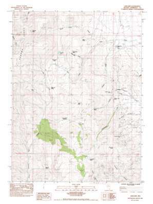
Adelaide Topo Map Nevada
To zoom in, hover over the map of Adelaide
USGS Topo Quad 40117g5 - 1:24,000 scale
| Topo Map Name: | Adelaide |
| USGS Topo Quad ID: | 40117g5 |
| Print Size: | ca. 21 1/4" wide x 27" high |
| Southeast Coordinates: | 40.75° N latitude / 117.5° W longitude |
| Map Center Coordinates: | 40.8125° N latitude / 117.5625° W longitude |
| U.S. State: | NV |
| Filename: | o40117g5.jpg |
| Download Map JPG Image: | Adelaide topo map 1:24,000 scale |
| Map Type: | Topographic |
| Topo Series: | 7.5´ |
| Map Scale: | 1:24,000 |
| Source of Map Images: | United States Geological Survey (USGS) |
| Alternate Map Versions: |
Adelaide NV 1983, updated 1983 Download PDF Buy paper map Adelaide NV 2011 Download PDF Buy paper map Adelaide NV 2014 Download PDF Buy paper map |
1:24,000 Topo Quads surrounding Adelaide
> Back to 40117e1 at 1:100,000 scale
> Back to 40116a1 at 1:250,000 scale
> Back to U.S. Topo Maps home
Adelaide topo map: Gazetteer
Adelaide: Basins
Big Squaw Valley elevation 2132m 6994′Stony Basin elevation 2072m 6797′
Adelaide: Flats
George Baine Meadows elevation 1981m 6499′Little Squaw Valley elevation 1904m 6246′
Adelaide: Lakes
Sonoma Lake elevation 2191m 7188′Adelaide: Mines
Adelaide Crown Mines elevation 1820m 5971′Cumberland Mine elevation 1840m 6036′
Adelaide: Populated Places
Adelaide (historical) elevation 1743m 5718′Gold Run (historical) elevation 1616m 5301′
Adelaide: Springs
Cumberland Spring elevation 2296m 7532′Granite Spring elevation 2009m 6591′
Harry Kaul Spring elevation 2017m 6617′
Reinhart Spring elevation 1948m 6391′
Ridge Spring elevation 2111m 6925′
Ridge Top Spring elevation 2059m 6755′
Willow Spring elevation 1831m 6007′
Adelaide: Streams
Broad Gulch Creek elevation 1677m 5501′Layson Creek elevation 1640m 5380′
Squaw Valley Creek elevation 1779m 5836′
Adelaide: Summits
Sonoma Peak elevation 2774m 9101′Adelaide digital topo map on disk
Buy this Adelaide topo map showing relief, roads, GPS coordinates and other geographical features, as a high-resolution digital map file on DVD:


