Toulon Peak Topo Map Nevada
To zoom in, hover over the map of Toulon Peak
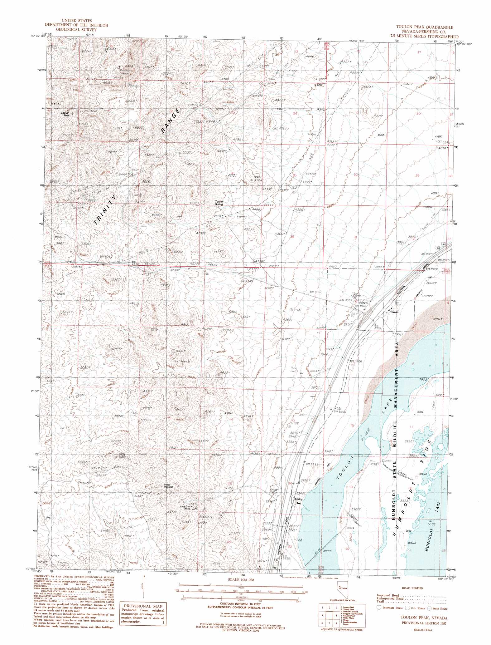
USGS Topo Quad 40118a6 - 1:24,000 scale
| Topo Map Name: | Toulon Peak |
| USGS Topo Quad ID: | 40118a6 |
| Print Size: | ca. 21 1/4" wide x 27" high |
| Southeast Coordinates: | 40° N latitude / 118.625° W longitude |
| Map Center Coordinates: | 40.0625° N latitude / 118.6875° W longitude |
| U.S. State: | NV |
| Filename: | o40118a6.jpg |
| Download Map JPG Image: | Toulon Peak topo map 1:24,000 scale |
| Map Type: | Topographic |
| Topo Series: | 7.5´ |
| Map Scale: | 1:24,000 |
| Source of Map Images: | United States Geological Survey (USGS) |
| Alternate Map Versions: |
Toulon Peak NV 1987, updated 1988 Download PDF Buy paper map Toulon Peak NV 2011 Download PDF Buy paper map Toulon Peak NV 2014 Download PDF Buy paper map |
1:24,000 Topo Quads surrounding Toulon Peak
Blue Wing Flat North |
Seven Troughs Se |
Trinity Pass |
Poker Brown Spring |
Arabia |
Blue Wing Flat South |
Lowry Well |
Trinity Peak |
West Of Lovelock |
Lovelock |
Ragged Top Mountain Sw |
Ragged Top Mountain |
Toulon Peak |
Granite Point |
Wildhorse Pass |
Jessup |
White Plains |
Ocala |
Lovelock Indian Caves |
Lone Rock Nw |
Desert Peak |
Parran |
Carson Sink Sw |
Carson Sink Se |
Lone Rock Sw |
> Back to 40118a1 at 1:100,000 scale
> Back to 40118a1 at 1:250,000 scale
> Back to U.S. Topo Maps home
Toulon Peak topo map: Gazetteer
Toulon Peak: Lakes
Toulon Lake elevation 1188m 3897′Toulon Peak: Mines
Coon Can Mines elevation 1394m 4573′Sheby Prospect elevation 1510m 4954′
Toulon Peak: Populated Places
Browns Station (historical) elevation 1214m 3982′Toulon elevation 1197m 3927′
Toy (historical) elevation 1199m 3933′
Toulon Peak: Post Offices
Browns Post Office elevation 1214m 3982′Toyland Post Office (historical) elevation 1214m 3982′
Toulon Peak: Springs
Toulon Spring elevation 1423m 4668′Toulon Peak: Summits
Toulon Peak elevation 2124m 6968′Toulon Peak digital topo map on disk
Buy this Toulon Peak topo map showing relief, roads, GPS coordinates and other geographical features, as a high-resolution digital map file on DVD: