Ragged Top Mountain Topo Map Nevada
To zoom in, hover over the map of Ragged Top Mountain
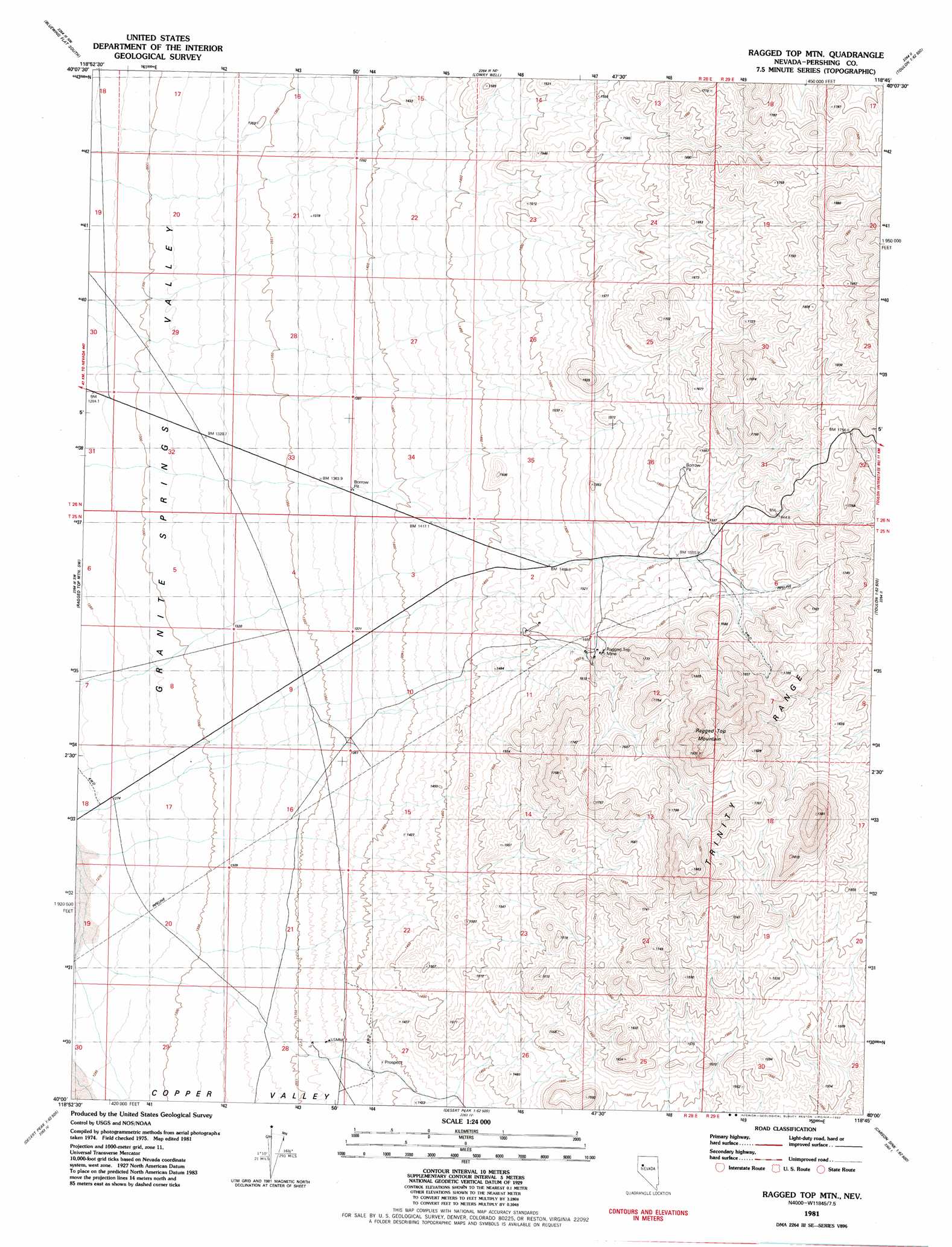
USGS Topo Quad 40118a7 - 1:24,000 scale
| Topo Map Name: | Ragged Top Mountain |
| USGS Topo Quad ID: | 40118a7 |
| Print Size: | ca. 21 1/4" wide x 27" high |
| Southeast Coordinates: | 40° N latitude / 118.75° W longitude |
| Map Center Coordinates: | 40.0625° N latitude / 118.8125° W longitude |
| U.S. State: | NV |
| Filename: | o40118a7.jpg |
| Download Map JPG Image: | Ragged Top Mountain topo map 1:24,000 scale |
| Map Type: | Topographic |
| Topo Series: | 7.5´ |
| Map Scale: | 1:24,000 |
| Source of Map Images: | United States Geological Survey (USGS) |
| Alternate Map Versions: |
Ragged Top Mtn NV 1981, updated 1982 Download PDF Buy paper map Ragged Top Mountain NV 2011 Download PDF Buy paper map Ragged Top Mountain NV 2014 Download PDF Buy paper map |
1:24,000 Topo Quads surrounding Ragged Top Mountain
Juniper Pass |
Blue Wing Flat North |
Seven Troughs Se |
Trinity Pass |
Poker Brown Spring |
Bob Spring |
Blue Wing Flat South |
Lowry Well |
Trinity Peak |
West Of Lovelock |
Bluewing Spring |
Ragged Top Mountain Sw |
Ragged Top Mountain |
Toulon Peak |
Granite Point |
Telephone Well |
Jessup |
White Plains |
Ocala |
Lovelock Indian Caves |
Hot Springs Flat |
Desert Peak |
Parran |
Carson Sink Sw |
Carson Sink Se |
> Back to 40118a1 at 1:100,000 scale
> Back to 40118a1 at 1:250,000 scale
> Back to U.S. Topo Maps home
Ragged Top Mountain topo map: Gazetteer
Ragged Top Mountain: Mines
Copper King Mine elevation 1370m 4494′Ragged Top Mine elevation 1575m 5167′
Ragged Top Mountain: Summits
Ragged Top Mountain elevation 1925m 6315′Ragged Top Mountain: Wells
Blue Wing Well elevation 1293m 4242′Ragged Top Mountain digital topo map on disk
Buy this Ragged Top Mountain topo map showing relief, roads, GPS coordinates and other geographical features, as a high-resolution digital map file on DVD: