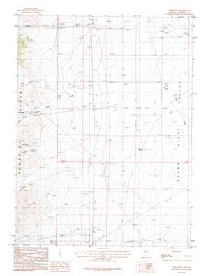
Unionville Topo Map Nevada
To zoom in, hover over the map of Unionville
USGS Topo Quad 40118d1 - 1:24,000 scale
| Topo Map Name: | Unionville |
| USGS Topo Quad ID: | 40118d1 |
| Print Size: | ca. 21 1/4" wide x 27" high |
| Southeast Coordinates: | 40.375° N latitude / 118° W longitude |
| Map Center Coordinates: | 40.4375° N latitude / 118.0625° W longitude |
| U.S. State: | NV |
| Filename: | o40118d1.jpg |
| Download Map JPG Image: | Unionville topo map 1:24,000 scale |
| Map Type: | Topographic |
| Topo Series: | 7.5´ |
| Map Scale: | 1:24,000 |
| Source of Map Images: | United States Geological Survey (USGS) |
| Alternate Map Versions: |
Unionville NV 1987, updated 1987 Download PDF Buy paper map Unionville NV 2011 Download PDF Buy paper map Unionville NV 2014 Download PDF Buy paper map |
1:24,000 Topo Quads surrounding Unionville
> Back to 40118a1 at 1:100,000 scale
> Back to 40118a1 at 1:250,000 scale
> Back to U.S. Topo Maps home
Unionville topo map: Gazetteer
Unionville: Mines
Black Warrior Mine elevation 1532m 5026′Unionville: Populated Places
Unionville elevation 1543m 5062′Unionville: Post Offices
Unionville Post Office elevation 1543m 5062′Unionville: Springs
Harrison Spring elevation 1280m 4199′Unionville: Streams
Cottonwood Creek elevation 1255m 4117′Coyote Creek elevation 1404m 4606′
Unionville: Valleys
Big Canyon elevation 1451m 4760′Buena Vista Canyon elevation 1532m 5026′
Cottonwood Canyon elevation 1416m 4645′
Coyote Canyon elevation 1464m 4803′
Indian Canyon elevation 1574m 5164′
Jackson Canyon elevation 1443m 4734′
Peru Canyon elevation 1514m 4967′
Unionville digital topo map on disk
Buy this Unionville topo map showing relief, roads, GPS coordinates and other geographical features, as a high-resolution digital map file on DVD:


