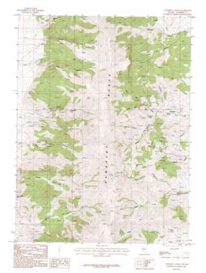
Congress Canyon Topo Map Nevada
To zoom in, hover over the map of Congress Canyon
USGS Topo Quad 40118d2 - 1:24,000 scale
| Topo Map Name: | Congress Canyon |
| USGS Topo Quad ID: | 40118d2 |
| Print Size: | ca. 21 1/4" wide x 27" high |
| Southeast Coordinates: | 40.375° N latitude / 118.125° W longitude |
| Map Center Coordinates: | 40.4375° N latitude / 118.1875° W longitude |
| U.S. State: | NV |
| Filename: | o40118d2.jpg |
| Download Map JPG Image: | Congress Canyon topo map 1:24,000 scale |
| Map Type: | Topographic |
| Topo Series: | 7.5´ |
| Map Scale: | 1:24,000 |
| Source of Map Images: | United States Geological Survey (USGS) |
| Alternate Map Versions: |
Congress Canyon NV 1987, updated 1988 Download PDF Buy paper map Congress Canyon NV 2011 Download PDF Buy paper map Congress Canyon NV 2015 Download PDF Buy paper map |
1:24,000 Topo Quads surrounding Congress Canyon
> Back to 40118a1 at 1:100,000 scale
> Back to 40118a1 at 1:250,000 scale
> Back to U.S. Topo Maps home
Congress Canyon topo map: Gazetteer
Congress Canyon: Flats
Fourth of July Flat elevation 2290m 7513′Congress Canyon: Mines
Arizona Mine elevation 1986m 6515′Bluebird Mine elevation 1811m 5941′
Buena Vista Canyon Mine elevation 1639m 5377′
Chipmunk Mine elevation 2309m 7575′
Congress Canyon Mine elevation 1873m 6145′
Henning Mine elevation 2016m 6614′
Inskip Mine elevation 2110m 6922′
La Toska Mine elevation 2372m 7782′
Marigold Mine elevation 1799m 5902′
Millionaire Mine elevation 1863m 6112′
Moonlight Mine elevation 1772m 5813′
Panther Canyon Mine elevation 1775m 5823′
Phlueger Mine elevation 1708m 5603′
Rusty Pick Mine elevation 1950m 6397′
Rye Patch Agnes Mine elevation 1574m 5164′
Rye Patch Mine elevation 1691m 5547′
Wheeler Mine elevation 1981m 6499′
Congress Canyon: Ranges
Humboldt Range elevation 2589m 8494′Congress Canyon: Streams
Congress Creek elevation 1681m 5515′Congress Canyon: Tunnels
Boston Tunnel elevation 1750m 5741′Congress Canyon: Valleys
Buffalo Canyon elevation 1642m 5387′Congress Canyon elevation 1688m 5538′
Echo Canyon elevation 1578m 5177′
John Brown Canyon elevation 1638m 5374′
Monitor Canyon elevation 1833m 6013′
North Fork Cottonwood Canyon elevation 1722m 5649′
North Fork Straight Canyon elevation 1688m 5538′
Panther Canyon elevation 1498m 4914′
South Fork Cottonwood Canyon elevation 1722m 5649′
South Fork Straight Canyon elevation 1835m 6020′
Wilson Canyon elevation 1688m 5538′
Congress Canyon digital topo map on disk
Buy this Congress Canyon topo map showing relief, roads, GPS coordinates and other geographical features, as a high-resolution digital map file on DVD:


