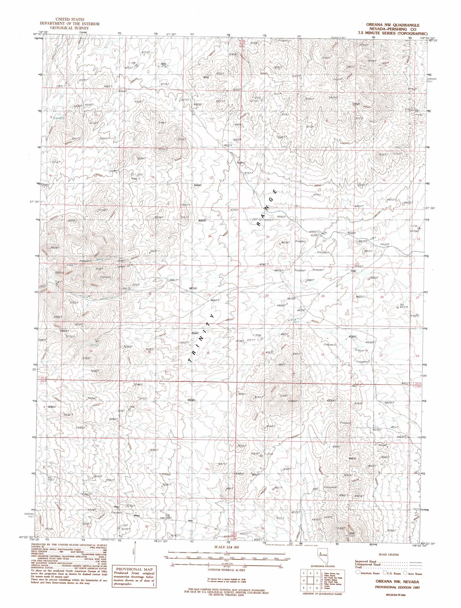
Oreana Nw Topo Map Nevada
To zoom in, hover over the map of Oreana Nw
USGS Topo Quad 40118d4 - 1:24,000 scale
| Topo Map Name: | Oreana Nw |
| USGS Topo Quad ID: | 40118d4 |
| Print Size: | ca. 21 1/4" wide x 27" high |
| Southeast Coordinates: | 40.375° N latitude / 118.375° W longitude |
| Map Center Coordinates: | 40.4375° N latitude / 118.4375° W longitude |
| U.S. State: | NV |
| Filename: | o40118d4.jpg |
| Download Map JPG Image: | Oreana Nw topo map 1:24,000 scale |
| Map Type: | Topographic |
| Topo Series: | 7.5´ |
| Map Scale: | 1:24,000 |
| Source of Map Images: | United States Geological Survey (USGS) |
| Alternate Map Versions: |
Oreana NW NV 1987, updated 1988 Download PDF Buy paper map Oreana NW NV 2011 Download PDF Buy paper map Oreana NW NV 2014 Download PDF Buy paper map |
1:24,000 Topo Quads surrounding Oreana Nw
Placerites |
Scossa |
Majuba Mountain |
Rye Patch Res North |
Imlay |
Rocky Canyon |
Poker Brown Gap |
Poker Brown |
Rye Patch Res South |
Star Peak |
Trinity Pass Nw |
Natchez Spring |
Oreana Nw |
Rye Patch Dam |
Congress Canyon |
Trinity Pass |
Poker Brown Spring |
Arabia |
Oreana |
Rochester |
Trinity Peak |
West Of Lovelock |
Lovelock |
Coal Canyon |
Buffalo Mountain |
> Back to 40118a1 at 1:100,000 scale
> Back to 40118a1 at 1:250,000 scale
> Back to U.S. Topo Maps home
Oreana Nw digital topo map on disk
Buy this Oreana Nw topo map showing relief, roads, GPS coordinates and other geographical features, as a high-resolution digital map file on DVD: