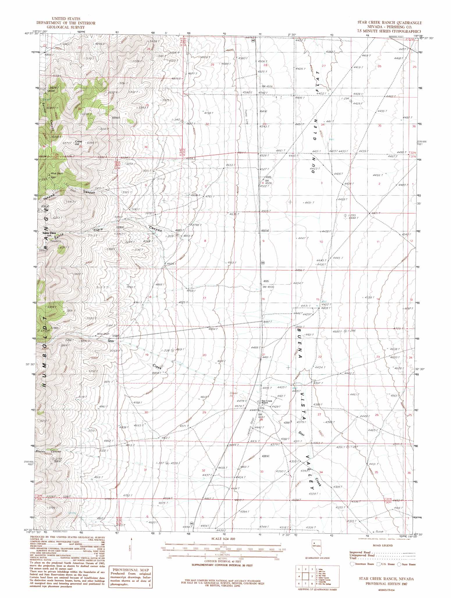
Star Creek Ranch Topo Map Nevada
To zoom in, hover over the map of Star Creek Ranch
USGS Topo Quad 40118e1 - 1:24,000 scale
| Topo Map Name: | Star Creek Ranch |
| USGS Topo Quad ID: | 40118e1 |
| Print Size: | ca. 21 1/4" wide x 27" high |
| Southeast Coordinates: | 40.5° N latitude / 118° W longitude |
| Map Center Coordinates: | 40.5625° N latitude / 118.0625° W longitude |
| U.S. State: | NV |
| Filename: | o40118e1.jpg |
| Download Map JPG Image: | Star Creek Ranch topo map 1:24,000 scale |
| Map Type: | Topographic |
| Topo Series: | 7.5´ |
| Map Scale: | 1:24,000 |
| Source of Map Images: | United States Geological Survey (USGS) |
| Alternate Map Versions: |
Star Creek Ranch NV 1987, updated 1987 Download PDF Buy paper map Star Creek Ranch NV 2011 Download PDF Buy paper map Star Creek Ranch NV 2014 Download PDF Buy paper map |
1:24,000 Topo Quads surrounding Star Creek Ranch
Alpha Mountain |
Woody Canyon |
Cosgrave |
Dun Glen Peak |
Rose Creek Mountain |
Rye Patch Res North |
Imlay |
Mill City |
Dun Glen |
Natchez Pass |
Rye Patch Res South |
Star Peak |
Star Creek Ranch |
Inskip Canyon |
Lee Peak |
Rye Patch Dam |
Congress Canyon |
Unionville |
Kyle Hot Springs |
Bartomes Spring |
Oreana |
Rochester |
Fitting |
Kyle Hot Springs Sw |
Granite Mountain |
> Back to 40118e1 at 1:100,000 scale
> Back to 40118a1 at 1:250,000 scale
> Back to U.S. Topo Maps home
Star Creek Ranch topo map: Gazetteer
Star Creek Ranch: Mines
Tehama Mine elevation 1874m 6148′Star Creek Ranch: Streams
Star Creek elevation 1348m 4422′Star Creek Ranch: Summits
Creek Hill elevation 1998m 6555′Star Creek Ranch: Valleys
Bloody Canyon elevation 1385m 4543′Santa Clara Canyon elevation 1462m 4796′
Star Canyon elevation 1562m 5124′
Tehama Canyon elevation 1588m 5209′
Star Creek Ranch digital topo map on disk
Buy this Star Creek Ranch topo map showing relief, roads, GPS coordinates and other geographical features, as a high-resolution digital map file on DVD: