Placerites Topo Map Nevada
To zoom in, hover over the map of Placerites
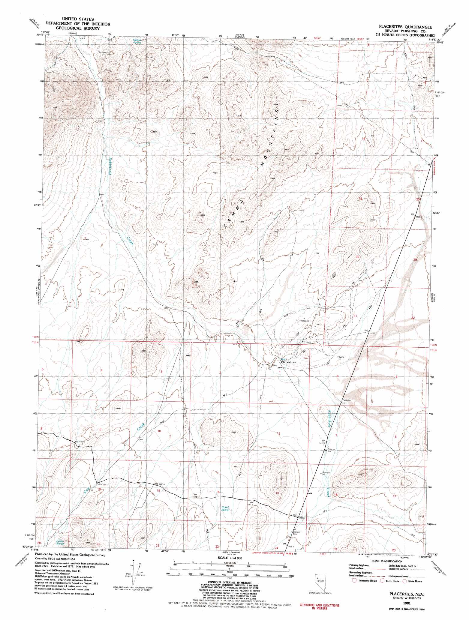
USGS Topo Quad 40118f6 - 1:24,000 scale
| Topo Map Name: | Placerites |
| USGS Topo Quad ID: | 40118f6 |
| Print Size: | ca. 21 1/4" wide x 27" high |
| Southeast Coordinates: | 40.625° N latitude / 118.625° W longitude |
| Map Center Coordinates: | 40.6875° N latitude / 118.6875° W longitude |
| U.S. State: | NV |
| Filename: | o40118f6.jpg |
| Download Map JPG Image: | Placerites topo map 1:24,000 scale |
| Map Type: | Topographic |
| Topo Series: | 7.5´ |
| Map Scale: | 1:24,000 |
| Source of Map Images: | United States Geological Survey (USGS) |
| Alternate Map Versions: |
Placerites NV 1981, updated 1982 Download PDF Buy paper map Placerites NV 2011 Download PDF Buy paper map Placerites NV 2014 Download PDF Buy paper map |
1:24,000 Topo Quads surrounding Placerites
Black Rock Point East |
Rabbithole Ne |
Floka |
Sugarloaf Knob |
Jungo |
Cholona |
Rabbithole |
Sulphur |
Sawtooth Knob |
Long Canyon |
Sheep Spring |
Dead Horse Canyon Ne |
Placerites |
Scossa |
Majuba Mountain |
Dead Horse Canyon |
Juniper Canyon |
Rocky Canyon |
Poker Brown Gap |
Poker Brown |
Seven Troughs Nw |
Seven Troughs |
Trinity Pass Nw |
Natchez Spring |
Oreana Nw |
> Back to 40118e1 at 1:100,000 scale
> Back to 40118a1 at 1:250,000 scale
> Back to U.S. Topo Maps home
Placerites topo map: Gazetteer
Placerites: Populated Places
Placerites elevation 1406m 4612′Placerites: Springs
Corral Spring elevation 1480m 4855′Judges Springs elevation 1622m 5321′
Outlaw Spring elevation 1458m 4783′
Placerites: Streams
Cow Creek elevation 1389m 4557′Placerites: Valleys
Cow Canyon elevation 1548m 5078′Placerites digital topo map on disk
Buy this Placerites topo map showing relief, roads, GPS coordinates and other geographical features, as a high-resolution digital map file on DVD: