Alpha Mountain Topo Map Nevada
To zoom in, hover over the map of Alpha Mountain
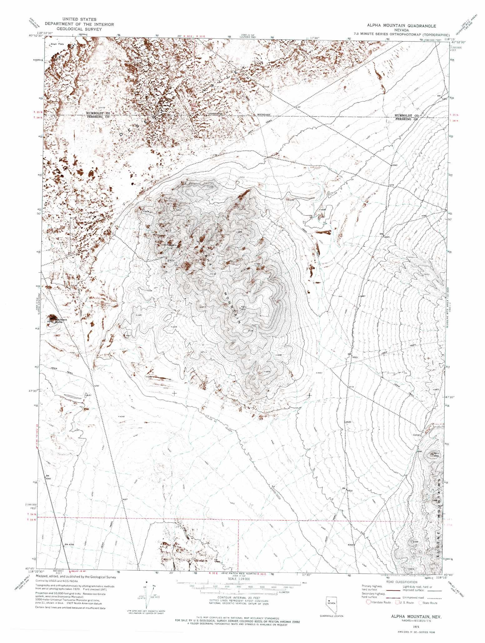
USGS Topo Quad 40118g3 - 1:24,000 scale
| Topo Map Name: | Alpha Mountain |
| USGS Topo Quad ID: | 40118g3 |
| Print Size: | ca. 21 1/4" wide x 27" high |
| Southeast Coordinates: | 40.75° N latitude / 118.25° W longitude |
| Map Center Coordinates: | 40.8125° N latitude / 118.3125° W longitude |
| U.S. State: | NV |
| Filename: | o40118g3.jpg |
| Download Map JPG Image: | Alpha Mountain topo map 1:24,000 scale |
| Map Type: | Topographic |
| Topo Series: | 7.5´ |
| Map Scale: | 1:24,000 |
| Source of Map Images: | United States Geological Survey (USGS) |
| Alternate Map Versions: |
Alpha Mountain NV 1971, updated 1977 Download PDF Buy paper map Alpha Mountain NV 2011 Download PDF Buy paper map Alpha Mountain NV 2014 Download PDF Buy paper map |
1:24,000 Topo Quads surrounding Alpha Mountain
Red Butte |
Donna Schee Spring |
Donna Schee Peak |
Lay Waterhole |
Mormon Dan Butte |
Sugarloaf Knob |
Jungo |
Jungo Ne |
Gaskell |
Pronto |
Sawtooth Knob |
Long Canyon |
Alpha Mountain |
Woody Canyon |
Cosgrave |
Scossa |
Majuba Mountain |
Rye Patch Res North |
Imlay |
Mill City |
Poker Brown Gap |
Poker Brown |
Rye Patch Res South |
Star Peak |
Star Creek Ranch |
> Back to 40118e1 at 1:100,000 scale
> Back to 40118a1 at 1:250,000 scale
> Back to U.S. Topo Maps home
Alpha Mountain topo map: Gazetteer
Alpha Mountain: Summits
Alpha Mountain elevation 1616m 5301′Haystack Butte elevation 1370m 4494′
Alpha Mountain digital topo map on disk
Buy this Alpha Mountain topo map showing relief, roads, GPS coordinates and other geographical features, as a high-resolution digital map file on DVD: