Bluewing Spring Topo Map Nevada
To zoom in, hover over the map of Bluewing Spring
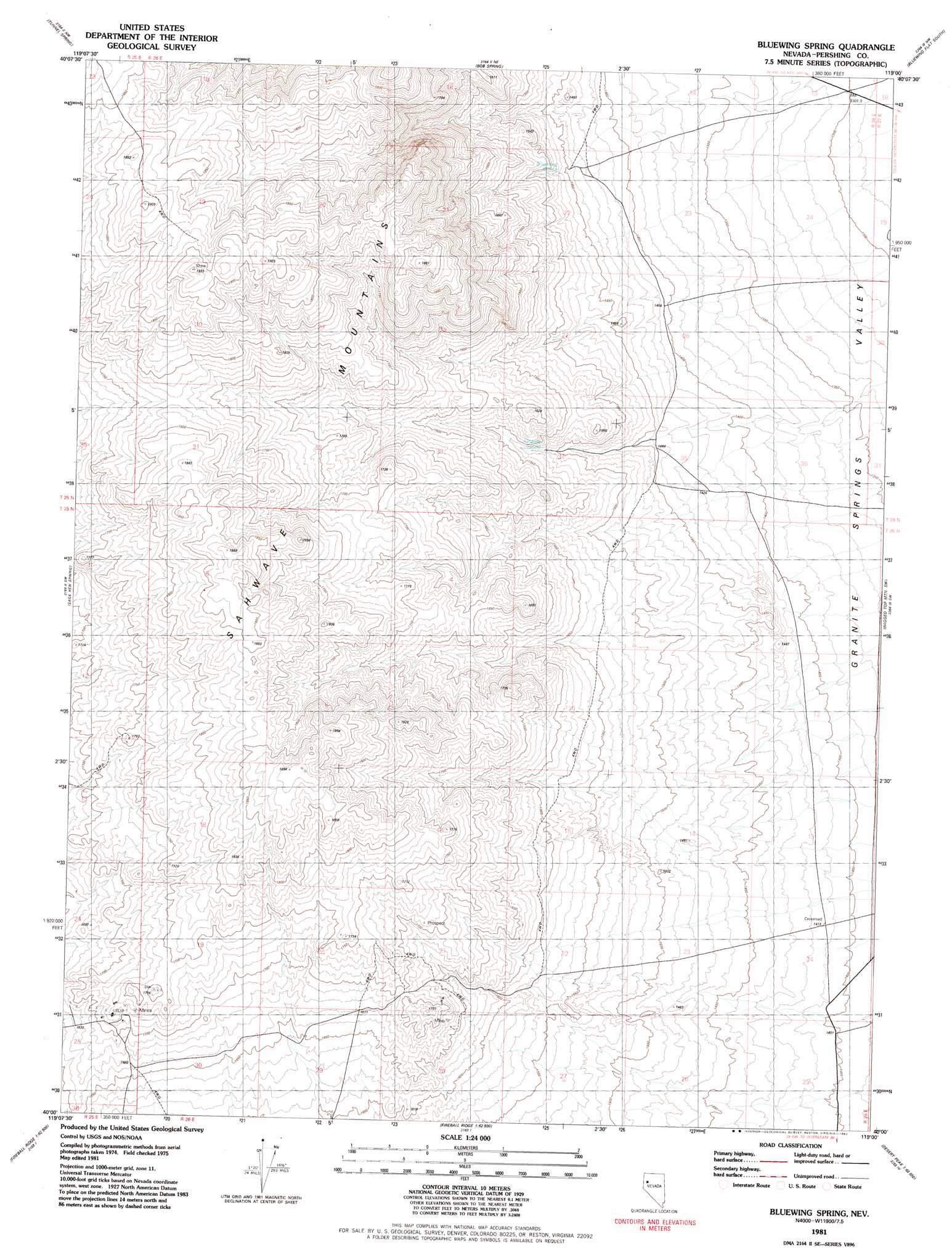
USGS Topo Quad 40119a1 - 1:24,000 scale
| Topo Map Name: | Bluewing Spring |
| USGS Topo Quad ID: | 40119a1 |
| Print Size: | ca. 21 1/4" wide x 27" high |
| Southeast Coordinates: | 40° N latitude / 119° W longitude |
| Map Center Coordinates: | 40.0625° N latitude / 119.0625° W longitude |
| U.S. State: | NV |
| Filename: | o40119a1.jpg |
| Download Map JPG Image: | Bluewing Spring topo map 1:24,000 scale |
| Map Type: | Topographic |
| Topo Series: | 7.5´ |
| Map Scale: | 1:24,000 |
| Source of Map Images: | United States Geological Survey (USGS) |
| Alternate Map Versions: |
Bluewing Spring NV 1981, updated 1982 Download PDF Buy paper map Bluewing Spring NV 2011 Download PDF Buy paper map Bluewing Spring NV 2014 Download PDF Buy paper map |
1:24,000 Topo Quads surrounding Bluewing Spring
Purgatory Peak |
Jayhawk Well |
Juniper Pass |
Blue Wing Flat North |
Seven Troughs Se |
Tohakum Peak Ne |
Tunnel Spring |
Bob Spring |
Blue Wing Flat South |
Lowry Well |
Tohakum Peak Se |
Sage Hen Spring |
Bluewing Spring |
Ragged Top Mountain Sw |
Ragged Top Mountain |
Russell Peak |
Black Warrior Peak |
Telephone Well |
Jessup |
White Plains |
Nixon |
Juniper Peak |
Hot Springs Flat |
Desert Peak |
Parran |
> Back to 40119a1 at 1:100,000 scale
> Back to 40118a1 at 1:250,000 scale
> Back to U.S. Topo Maps home
Bluewing Spring topo map: Gazetteer
Bluewing Spring: Mines
Blue Wing Mine elevation 1682m 5518′Star Mine elevation 1731m 5679′
Bluewing Spring: Springs
Bluewing Spring elevation 1460m 4790′Granite Spring elevation 1514m 4967′
Bluewing Spring digital topo map on disk
Buy this Bluewing Spring topo map showing relief, roads, GPS coordinates and other geographical features, as a high-resolution digital map file on DVD: