Juniper Pass Topo Map Nevada
To zoom in, hover over the map of Juniper Pass
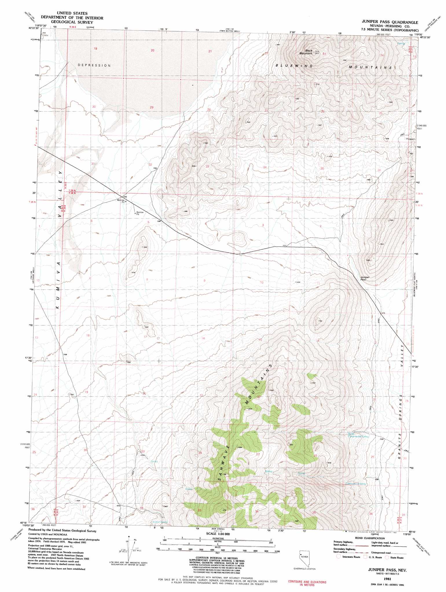
USGS Topo Quad 40119c1 - 1:24,000 scale
| Topo Map Name: | Juniper Pass |
| USGS Topo Quad ID: | 40119c1 |
| Print Size: | ca. 21 1/4" wide x 27" high |
| Southeast Coordinates: | 40.25° N latitude / 119° W longitude |
| Map Center Coordinates: | 40.3125° N latitude / 119.0625° W longitude |
| U.S. State: | NV |
| Filename: | o40119c1.jpg |
| Download Map JPG Image: | Juniper Pass topo map 1:24,000 scale |
| Map Type: | Topographic |
| Topo Series: | 7.5´ |
| Map Scale: | 1:24,000 |
| Source of Map Images: | United States Geological Survey (USGS) |
| Alternate Map Versions: |
Juniper Pass NV 1981, updated 1982 Download PDF Buy paper map Juniper Pass NV 2011 Download PDF Buy paper map Juniper Pass NV 2014 Download PDF Buy paper map |
1:24,000 Topo Quads surrounding Juniper Pass
Empire |
Tenmile |
Eagle Rock Spring |
Dead Horse Canyon |
Juniper Canyon |
Kumiva Peak |
Betty Creek |
Twin Buttes Well |
Seven Troughs Nw |
Seven Troughs |
Purgatory Peak |
Jayhawk Well |
Juniper Pass |
Blue Wing Flat North |
Seven Troughs Se |
Tohakum Peak Ne |
Tunnel Spring |
Bob Spring |
Blue Wing Flat South |
Lowry Well |
Tohakum Peak Se |
Sage Hen Spring |
Bluewing Spring |
Ragged Top Mountain Sw |
Ragged Top Mountain |
> Back to 40119a1 at 1:100,000 scale
> Back to 40118a1 at 1:250,000 scale
> Back to U.S. Topo Maps home
Juniper Pass topo map: Gazetteer
Juniper Pass: Gaps
Juniper Pass elevation 1297m 4255′Juniper Pass: Ranges
Blue Wing Mountains elevation 1983m 6505′Juniper Pass: Springs
Cottonwood Spring elevation 1357m 4452′Juniper Spring elevation 1750m 5741′
North Cottonwood Spring elevation 1369m 4491′
West Juniper Spring elevation 1544m 5065′
Juniper Pass: Summits
Black Mountain elevation 2008m 6587′Juniper Pass digital topo map on disk
Buy this Juniper Pass topo map showing relief, roads, GPS coordinates and other geographical features, as a high-resolution digital map file on DVD: