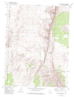
Parker Canyon Topo Map Nevada
To zoom in, hover over the map of Parker Canyon
USGS Topo Quad 40119c8 - 1:24,000 scale
| Topo Map Name: | Parker Canyon |
| USGS Topo Quad ID: | 40119c8 |
| Print Size: | ca. 21 1/4" wide x 27" high |
| Southeast Coordinates: | 40.25° N latitude / 119.875° W longitude |
| Map Center Coordinates: | 40.3125° N latitude / 119.9375° W longitude |
| U.S. States: | NV, CA |
| Filename: | o40119c8.jpg |
| Download Map JPG Image: | Parker Canyon topo map 1:24,000 scale |
| Map Type: | Topographic |
| Topo Series: | 7.5´ |
| Map Scale: | 1:24,000 |
| Source of Map Images: | United States Geological Survey (USGS) |
| Alternate Map Versions: |
Parker Canyon NV 1980, updated 1980 Download PDF Buy paper map Parker Canyon NV 2011 Download PDF Buy paper map Parker Canyon NV 2014 Download PDF Buy paper map |
1:24,000 Topo Quads surrounding Parker Canyon
> Back to 40119a1 at 1:100,000 scale
> Back to 40118a1 at 1:250,000 scale
> Back to U.S. Topo Maps home
Parker Canyon topo map: Gazetteer
Parker Canyon: Dams
Skedaddle Dam (historical) elevation 1409m 4622′Parker Canyon: Ranges
Smoke Creek Mountains elevation 1586m 5203′Parker Canyon: Springs
Pipe Spring elevation 1429m 4688′Telephone Spring elevation 1538m 5045′
Parker Canyon: Valleys
Parker Canyon elevation 1299m 4261′Thomas Canyon elevation 1347m 4419′
Parker Canyon digital topo map on disk
Buy this Parker Canyon topo map showing relief, roads, GPS coordinates and other geographical features, as a high-resolution digital map file on DVD:


