Betty Creek Topo Map Nevada
To zoom in, hover over the map of Betty Creek
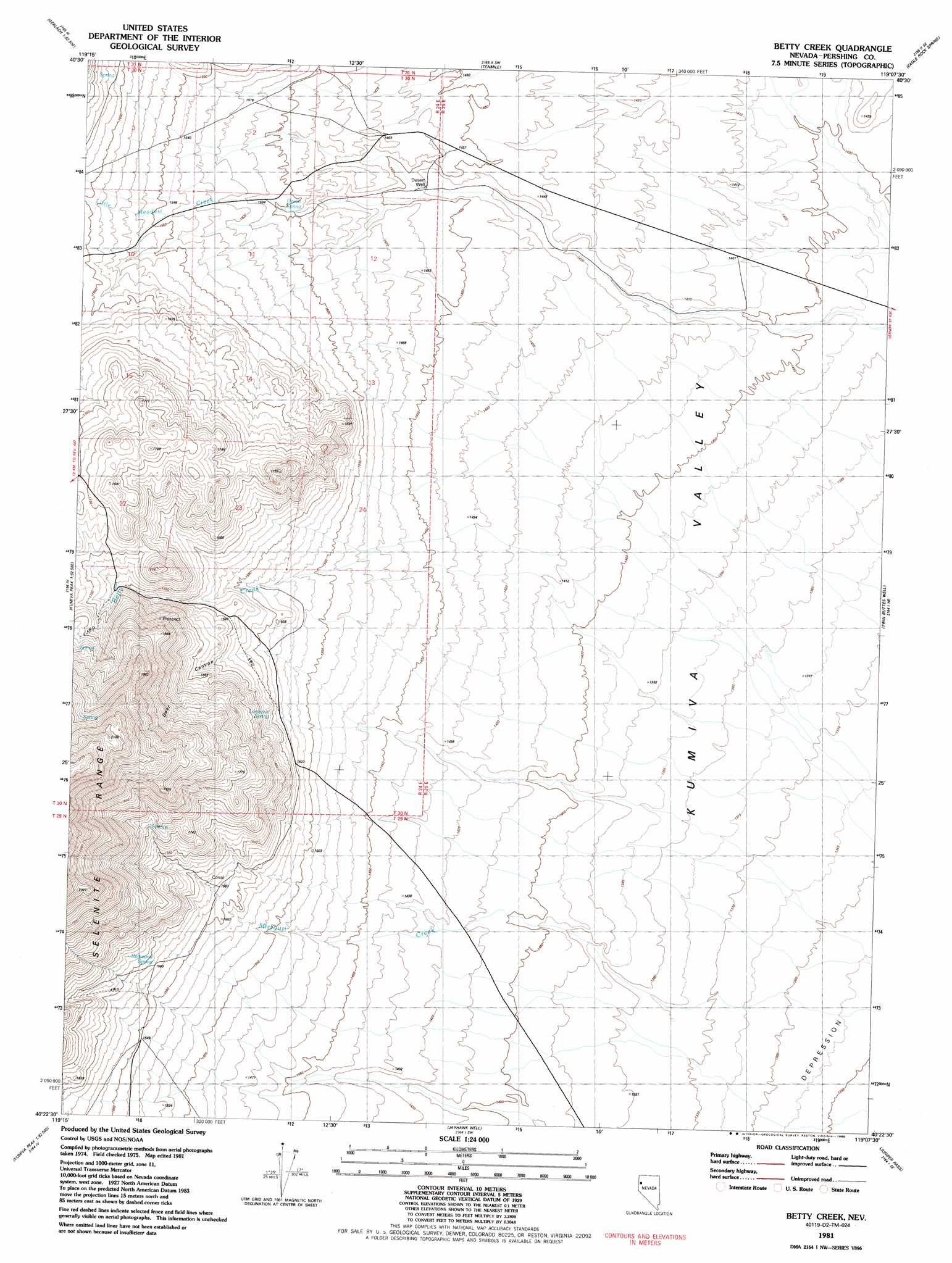
USGS Topo Quad 40119d2 - 1:24,000 scale
| Topo Map Name: | Betty Creek |
| USGS Topo Quad ID: | 40119d2 |
| Print Size: | ca. 21 1/4" wide x 27" high |
| Southeast Coordinates: | 40.375° N latitude / 119.125° W longitude |
| Map Center Coordinates: | 40.4375° N latitude / 119.1875° W longitude |
| U.S. State: | NV |
| Filename: | o40119d2.jpg |
| Download Map JPG Image: | Betty Creek topo map 1:24,000 scale |
| Map Type: | Topographic |
| Topo Series: | 7.5´ |
| Map Scale: | 1:24,000 |
| Source of Map Images: | United States Geological Survey (USGS) |
| Alternate Map Versions: |
Betty Creek NV 1981, updated 1982 Download PDF Buy paper map Betty Creek NV 1981, updated 1985 Download PDF Buy paper map Betty Creek NV 2011 Download PDF Buy paper map Betty Creek NV 2014 Download PDF Buy paper map |
1:24,000 Topo Quads surrounding Betty Creek
Godeys Rock |
Gerlach |
Dry Mountain Nw |
Dry Mountain |
Sheep Spring |
West Of Empire |
Empire |
Tenmile |
Eagle Rock Spring |
Dead Horse Canyon |
San Emidio Desert North |
Kumiva Peak |
Betty Creek |
Twin Buttes Well |
Seven Troughs Nw |
San Emidio Desert South |
Purgatory Peak |
Jayhawk Well |
Juniper Pass |
Blue Wing Flat North |
Tohakum Peak Nw |
Tohakum Peak Ne |
Tunnel Spring |
Bob Spring |
Blue Wing Flat South |
> Back to 40119a1 at 1:100,000 scale
> Back to 40118a1 at 1:250,000 scale
> Back to U.S. Topo Maps home
Betty Creek topo map: Gazetteer
Betty Creek: Springs
Desert Spring elevation 1492m 4895′Lookout Spring elevation 1550m 5085′
Redwood Spring elevation 1587m 5206′
Betty Creek: Valleys
Deer Canyon elevation 1592m 5223′Betty Creek: Wells
Desert Well elevation 1441m 4727′Betty Creek digital topo map on disk
Buy this Betty Creek topo map showing relief, roads, GPS coordinates and other geographical features, as a high-resolution digital map file on DVD: