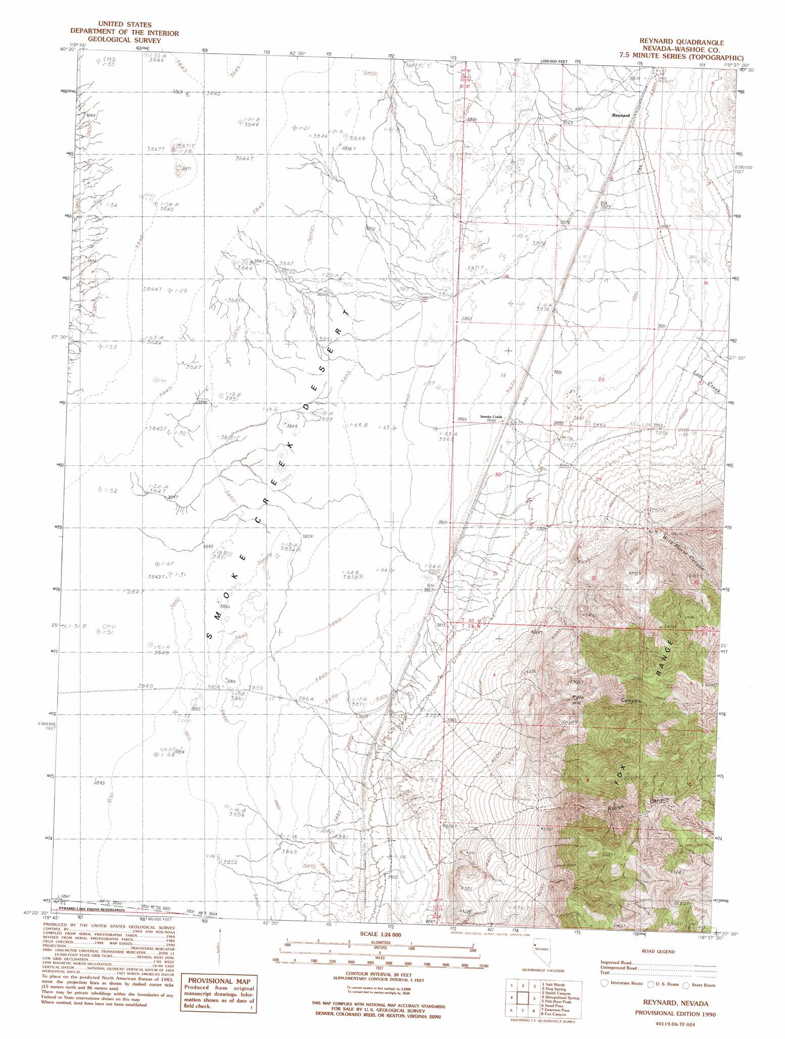
Reynard Topo Map Nevada
To zoom in, hover over the map of Reynard
USGS Topo Quad 40119d6 - 1:24,000 scale
| Topo Map Name: | Reynard |
| USGS Topo Quad ID: | 40119d6 |
| Print Size: | ca. 21 1/4" wide x 27" high |
| Southeast Coordinates: | 40.375° N latitude / 119.625° W longitude |
| Map Center Coordinates: | 40.4375° N latitude / 119.6875° W longitude |
| U.S. State: | NV |
| Filename: | o40119d6.jpg |
| Download Map JPG Image: | Reynard topo map 1:24,000 scale |
| Map Type: | Topographic |
| Topo Series: | 7.5´ |
| Map Scale: | 1:24,000 |
| Source of Map Images: | United States Geological Survey (USGS) |
| Alternate Map Versions: |
Reynard NV 1990, updated 1990 Download PDF Buy paper map Reynard NV 2011 Download PDF Buy paper map Reynard NV 2015 Download PDF Buy paper map |
1:24,000 Topo Quads surrounding Reynard
Mixie Flat |
Buffalo Creek |
Horse Canyon |
Wall Spring |
Godeys Rock |
Smoke Creek Ranch |
Salt Marsh |
Hog Spring |
Smith Canyon |
West Of Empire |
Red Rock Canyon |
Sheepshead Spring |
Reynard |
Pah-Rum Peak |
San Emidio Desert North |
Parker Canyon |
Sand Pass |
Emerson Pass |
Fox Canyon |
San Emidio Desert South |
Flanigan |
Astor Pass |
The Needle Rocks |
Pyramid Ne |
Tohakum Peak Nw |
> Back to 40119a1 at 1:100,000 scale
> Back to 40118a1 at 1:250,000 scale
> Back to U.S. Topo Maps home
Reynard topo map: Gazetteer
Reynard: Plains
Smoke Creek Desert elevation 1174m 3851′Reynard: Populated Places
Smoke Creek elevation 1184m 3884′Reynard: Post Offices
Smoke Creek Post Office (historical) elevation 1184m 3884′Reynard: Streams
Lost Creek elevation 1203m 3946′Wild Horse Creek elevation 1245m 4084′
Reynard: Valleys
Pole Canyon elevation 1283m 4209′Rough Canyon elevation 1349m 4425′
Wild Horse Canyon elevation 1219m 3999′
Reynard digital topo map on disk
Buy this Reynard topo map showing relief, roads, GPS coordinates and other geographical features, as a high-resolution digital map file on DVD: