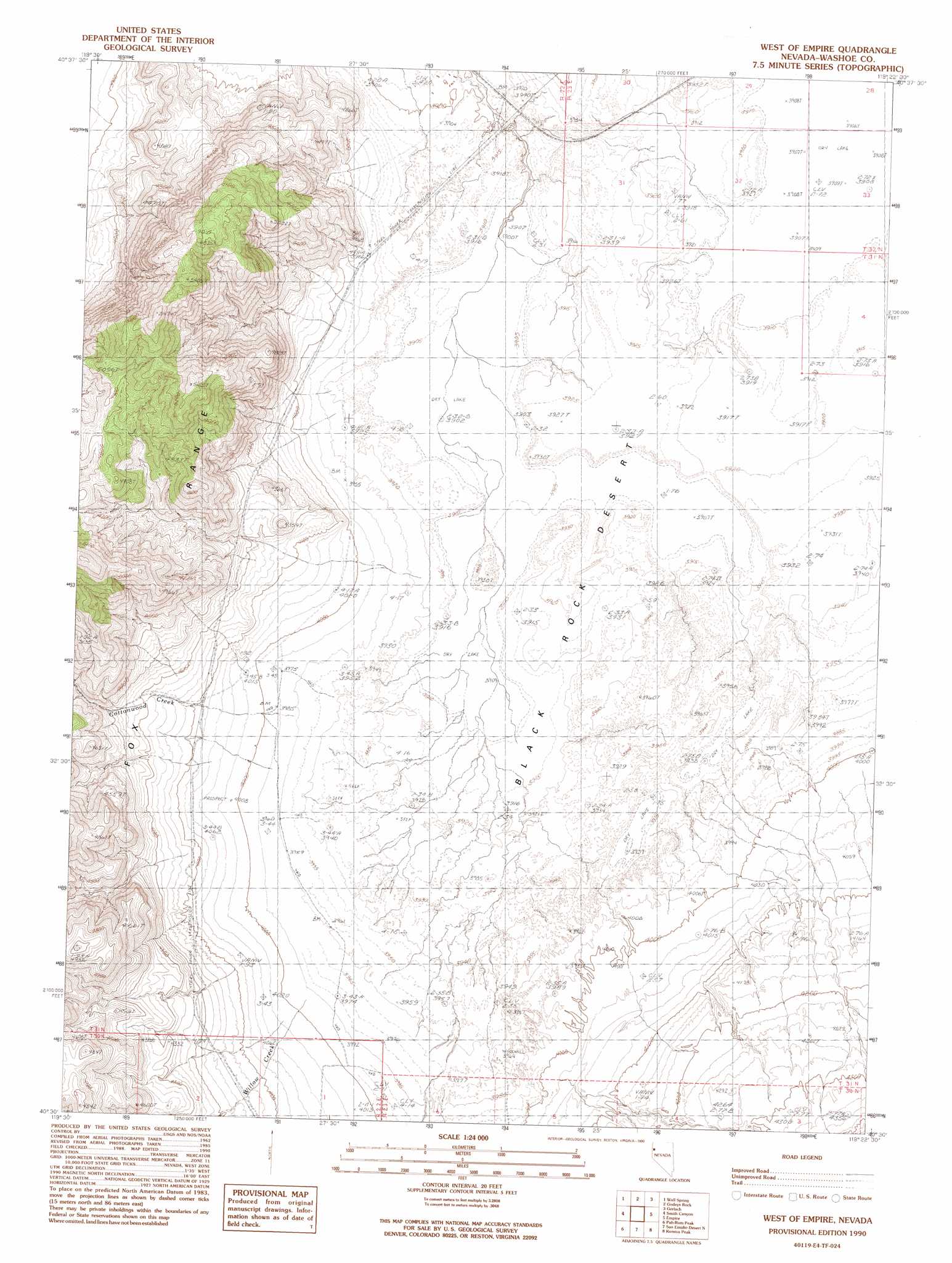
West Of Empire Topo Map Nevada
To zoom in, hover over the map of West Of Empire
USGS Topo Quad 40119e4 - 1:24,000 scale
| Topo Map Name: | West Of Empire |
| USGS Topo Quad ID: | 40119e4 |
| Print Size: | ca. 21 1/4" wide x 27" high |
| Southeast Coordinates: | 40.5° N latitude / 119.375° W longitude |
| Map Center Coordinates: | 40.5625° N latitude / 119.4375° W longitude |
| U.S. State: | NV |
| Filename: | o40119e4.jpg |
| Download Map JPG Image: | West Of Empire topo map 1:24,000 scale |
| Map Type: | Topographic |
| Topo Series: | 7.5´ |
| Map Scale: | 1:24,000 |
| Source of Map Images: | United States Geological Survey (USGS) |
| Alternate Map Versions: |
West of Empire NV 1990, updated 1990 Download PDF Buy paper map West of Empire NV 2011 Download PDF Buy paper map West of Empire NV 2014 Download PDF Buy paper map |
1:24,000 Topo Quads surrounding West Of Empire
Poodle Mountain |
Squaw Valley |
The Banjo |
Hualapai Flat South |
Trego |
Horse Canyon |
Wall Spring |
Godeys Rock |
Gerlach |
Dry Mountain Nw |
Hog Spring |
Smith Canyon |
West Of Empire |
Empire |
Tenmile |
Reynard |
Pah-Rum Peak |
San Emidio Desert North |
Kumiva Peak |
Betty Creek |
Emerson Pass |
Fox Canyon |
San Emidio Desert South |
Purgatory Peak |
Jayhawk Well |
> Back to 40119e1 at 1:100,000 scale
> Back to 40118a1 at 1:250,000 scale
> Back to U.S. Topo Maps home
West Of Empire topo map: Gazetteer
West Of Empire: Streams
Cottonwood Creek elevation 1209m 3966′Willow Creek elevation 1216m 3989′
West Of Empire digital topo map on disk
Buy this West Of Empire topo map showing relief, roads, GPS coordinates and other geographical features, as a high-resolution digital map file on DVD: