Trego Topo Map Nevada
To zoom in, hover over the map of Trego
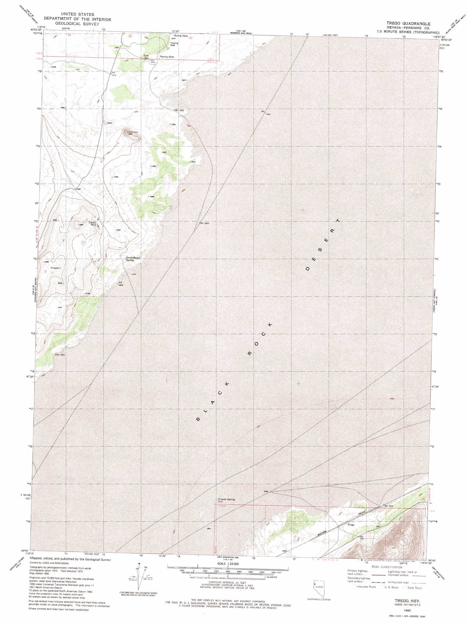
USGS Topo Quad 40119g2 - 1:24,000 scale
| Topo Map Name: | Trego |
| USGS Topo Quad ID: | 40119g2 |
| Print Size: | ca. 21 1/4" wide x 27" high |
| Southeast Coordinates: | 40.75° N latitude / 119.125° W longitude |
| Map Center Coordinates: | 40.8125° N latitude / 119.1875° W longitude |
| U.S. State: | NV |
| Filename: | o40119g2.jpg |
| Download Map JPG Image: | Trego topo map 1:24,000 scale |
| Map Type: | Topographic |
| Topo Series: | 7.5´ |
| Map Scale: | 1:24,000 |
| Source of Map Images: | United States Geological Survey (USGS) |
| Alternate Map Versions: |
Trego NV 1980, updated 1981 Download PDF Buy paper map Trego NV 2011 Download PDF Buy paper map Trego NV 2014 Download PDF Buy paper map |
1:24,000 Topo Quads surrounding Trego
Leadville |
Division Peak |
Donnelly Creek |
Double Hot Springs |
Pidgeon Spring Sw |
Melody Mountain |
Hualapai Flat North |
Mormon Dan Peak |
Black Rock Point West |
Black Rock Point East |
The Banjo |
Hualapai Flat South |
Trego |
Trego Hot Springs |
Cholona |
Godeys Rock |
Gerlach |
Dry Mountain Nw |
Dry Mountain |
Sheep Spring |
West Of Empire |
Empire |
Tenmile |
Eagle Rock Spring |
Dead Horse Canyon |
> Back to 40119e1 at 1:100,000 scale
> Back to 40118a1 at 1:250,000 scale
> Back to U.S. Topo Maps home
Trego topo map: Gazetteer
Trego: Mines
Cassidy Mine elevation 1261m 4137′Trego: Populated Places
Trego elevation 1193m 3914′Trego: Springs
Coyote Spring elevation 1193m 3914′Lost Spring elevation 1195m 3920′
Secondhand Spring elevation 1200m 3937′
Trego: Summits
Steamboat Mountain elevation 1296m 4251′Trego digital topo map on disk
Buy this Trego topo map showing relief, roads, GPS coordinates and other geographical features, as a high-resolution digital map file on DVD: