Hualapai Flat North Topo Map Nevada
To zoom in, hover over the map of Hualapai Flat North
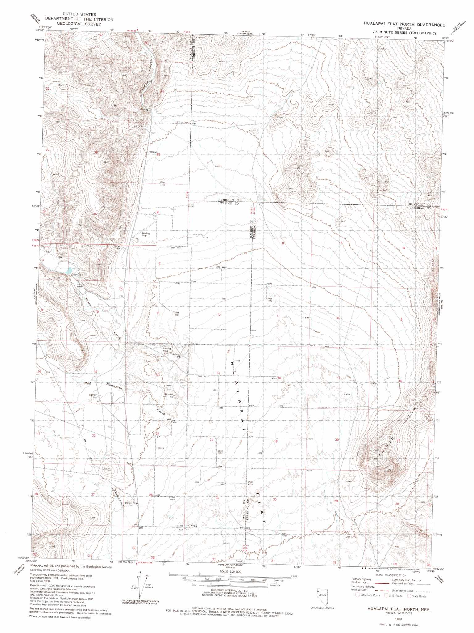
USGS Topo Quad 40119h3 - 1:24,000 scale
| Topo Map Name: | Hualapai Flat North |
| USGS Topo Quad ID: | 40119h3 |
| Print Size: | ca. 21 1/4" wide x 27" high |
| Southeast Coordinates: | 40.875° N latitude / 119.25° W longitude |
| Map Center Coordinates: | 40.9375° N latitude / 119.3125° W longitude |
| U.S. State: | NV |
| Filename: | o40119h3.jpg |
| Download Map JPG Image: | Hualapai Flat North topo map 1:24,000 scale |
| Map Type: | Topographic |
| Topo Series: | 7.5´ |
| Map Scale: | 1:24,000 |
| Source of Map Images: | United States Geological Survey (USGS) |
| Alternate Map Versions: |
Hualapai Flat North NV 1980, updated 1980 Download PDF Buy paper map Hualapai Flat North NV 2011 Download PDF Buy paper map Hualapai Flat North NV 2014 Download PDF Buy paper map |
1:24,000 Topo Quads surrounding Hualapai Flat North
Chester Lyons Spring |
Butte Spring |
Mcconnel Canyon |
Wagner Springs |
Clapper Creek |
Fox Mountain |
Leadville |
Division Peak |
Donnelly Creek |
Double Hot Springs |
Crutcher Canyon |
Melody Mountain |
Hualapai Flat North |
Mormon Dan Peak |
Black Rock Point West |
Squaw Valley |
The Banjo |
Hualapai Flat South |
Trego |
Trego Hot Springs |
Wall Spring |
Godeys Rock |
Gerlach |
Dry Mountain Nw |
Dry Mountain |
> Back to 40119e1 at 1:100,000 scale
> Back to 40118a1 at 1:250,000 scale
> Back to U.S. Topo Maps home
Hualapai Flat North topo map: Gazetteer
Hualapai Flat North: Populated Places
Hualipi (historical) elevation 1223m 4012′Hualapai Flat North: Post Offices
Hualipi Post Office (historical) elevation 1223m 4012′Hualapai Flat North: Streams
Negro Creek elevation 1237m 4058′Hualapai Flat North: Valleys
Leadville Canyon elevation 1292m 4238′Hualapai Flat North: Wells
Bailey Well elevation 1245m 4084′Hualapai Flat North digital topo map on disk
Buy this Hualapai Flat North topo map showing relief, roads, GPS coordinates and other geographical features, as a high-resolution digital map file on DVD: