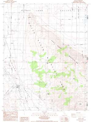
Doyle Topo Map California
To zoom in, hover over the map of Doyle
USGS Topo Quad 40120a1 - 1:24,000 scale
| Topo Map Name: | Doyle |
| USGS Topo Quad ID: | 40120a1 |
| Print Size: | ca. 21 1/4" wide x 27" high |
| Southeast Coordinates: | 40° N latitude / 120° W longitude |
| Map Center Coordinates: | 40.0625° N latitude / 120.0625° W longitude |
| U.S. State: | CA |
| Filename: | o40120a1.jpg |
| Download Map JPG Image: | Doyle topo map 1:24,000 scale |
| Map Type: | Topographic |
| Topo Series: | 7.5´ |
| Map Scale: | 1:24,000 |
| Source of Map Images: | United States Geological Survey (USGS) |
| Alternate Map Versions: |
Doyle CA 1988, updated 1989 Download PDF Buy paper map Doyle CA 1988, updated 1989 Download PDF Buy paper map Doyle CA 2012 Download PDF Buy paper map Doyle CA 2015 Download PDF Buy paper map |
1:24,000 Topo Quads surrounding Doyle
> Back to 40120a1 at 1:100,000 scale
> Back to 40120a1 at 1:250,000 scale
> Back to U.S. Topo Maps home
Doyle topo map: Gazetteer
Doyle: Parks
Doyle State Wildlife Area elevation 1674m 5492′Doyle: Populated Places
Doyle elevation 1303m 4274′Doyle: Ranges
Fort Sage Mountains elevation 1987m 6519′Doyle: Springs
Indian Spring elevation 1505m 4937′Jesus Spring elevation 1914m 6279′
Steffens Spring elevation 1412m 4632′
Willow Springs elevation 1776m 5826′
Doyle: Streams
Willow Ranch Creek elevation 1307m 4288′Doyle: Summits
Turtle Mountain elevation 1457m 4780′Doyle: Valleys
Long Valley elevation 1288m 4225′Doyle digital topo map on disk
Buy this Doyle topo map showing relief, roads, GPS coordinates and other geographical features, as a high-resolution digital map file on DVD:


