Milford Topo Map California
To zoom in, hover over the map of Milford
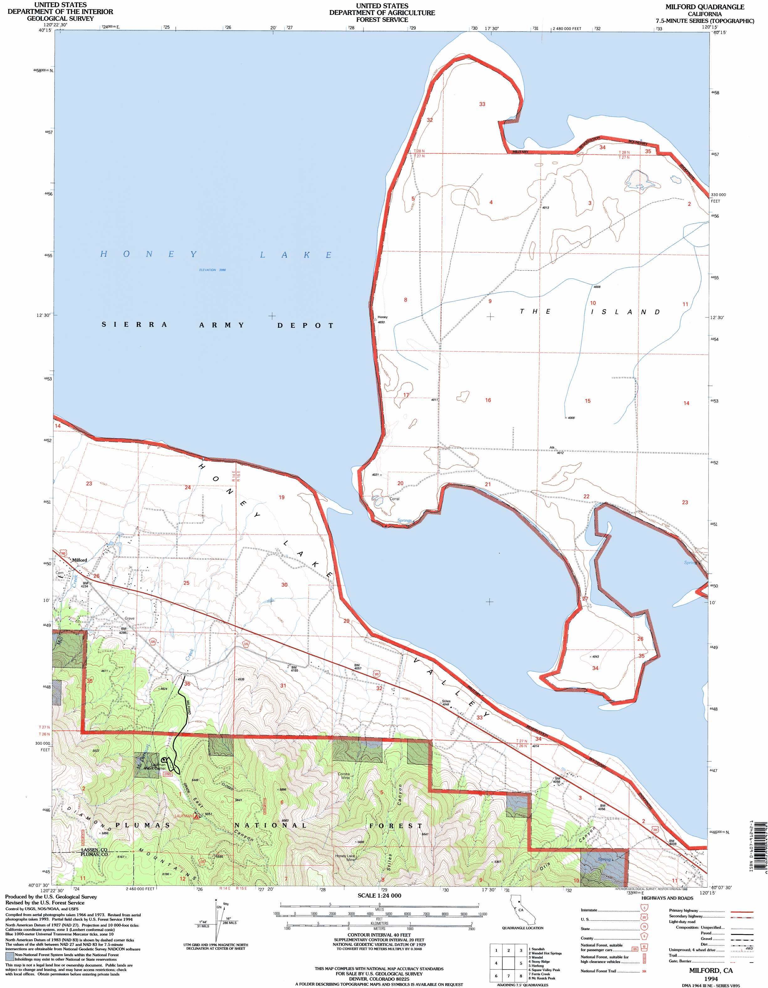
USGS Topo Quad 40120b3 - 1:24,000 scale
| Topo Map Name: | Milford |
| USGS Topo Quad ID: | 40120b3 |
| Print Size: | ca. 21 1/4" wide x 27" high |
| Southeast Coordinates: | 40.125° N latitude / 120.25° W longitude |
| Map Center Coordinates: | 40.1875° N latitude / 120.3125° W longitude |
| U.S. State: | CA |
| Filename: | o40120b3.jpg |
| Download Map JPG Image: | Milford topo map 1:24,000 scale |
| Map Type: | Topographic |
| Topo Series: | 7.5´ |
| Map Scale: | 1:24,000 |
| Source of Map Images: | United States Geological Survey (USGS) |
| Alternate Map Versions: |
Milford CA 1977, updated 1978 Download PDF Buy paper map Milford CA 1994, updated 1998 Download PDF Buy paper map Milford CA 2012 Download PDF Buy paper map Milford CA 2015 Download PDF Buy paper map |
| FStopo: | US Forest Service topo Milford is available: Download FStopo PDF Download FStopo TIF |
1:24,000 Topo Quads surrounding Milford
Johnstonville |
Litchfield |
Shaffer Mountain |
Little Mud Flat |
Bull Flat |
Janesville |
Standish |
Wendel Hot Springs |
Wendel |
Spencer Creek |
Antelope Lake |
Stony Ridge |
Milford |
Herlong |
Calneva |
Babcock Peak |
Squaw Valley Peak |
Ferris Creek |
Mckesick Peak |
Doyle |
Grizzly Valley |
Crocker Mountain |
Dixie Mountain |
Frenchman Lake |
Constantia |
> Back to 40120a1 at 1:100,000 scale
> Back to 40120a1 at 1:250,000 scale
> Back to U.S. Topo Maps home
Milford topo map: Gazetteer
Milford: Capes
The Island elevation 1223m 4012′Milford: Lakes
Honey Lake elevation 1216m 3989′Milford: Mines
Corona Mine elevation 1387m 4550′Honey Lake Mine elevation 1714m 5623′
Milford: Populated Places
Milford elevation 1287m 4222′Milford: Streams
McDermott Creek elevation 1226m 4022′Mill Creek elevation 1229m 4032′
Milford: Valleys
East Canyon elevation 1391m 4563′Otis Canyon elevation 1264m 4146′
Stiles Canyon elevation 1289m 4229′
Milford digital topo map on disk
Buy this Milford topo map showing relief, roads, GPS coordinates and other geographical features, as a high-resolution digital map file on DVD: