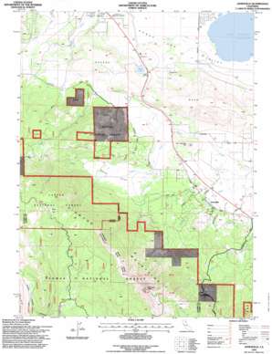
Janesville Topo Map California
To zoom in, hover over the map of Janesville
USGS Topo Quad 40120c5 - 1:24,000 scale
| Topo Map Name: | Janesville |
| USGS Topo Quad ID: | 40120c5 |
| Print Size: | ca. 21 1/4" wide x 27" high |
| Southeast Coordinates: | 40.25° N latitude / 120.5° W longitude |
| Map Center Coordinates: | 40.3125° N latitude / 120.5625° W longitude |
| U.S. State: | CA |
| Filename: | o40120c5.jpg |
| Download Map JPG Image: | Janesville topo map 1:24,000 scale |
| Map Type: | Topographic |
| Topo Series: | 7.5´ |
| Map Scale: | 1:24,000 |
| Source of Map Images: | United States Geological Survey (USGS) |
| Alternate Map Versions: |
Janesville CA 1972, updated 1974 Download PDF Buy paper map Janesville CA 1994, updated 1998 Download PDF Buy paper map Janesville CA 1994, updated 1998 Download PDF Buy paper map Janesville CA 2012 Download PDF Buy paper map Janesville CA 2015 Download PDF Buy paper map |
| FStopo: | US Forest Service topo Janesville is available: Download FStopo PDF Download FStopo TIF |
1:24,000 Topo Quads surrounding Janesville
> Back to 40120a1 at 1:100,000 scale
> Back to 40120a1 at 1:250,000 scale
> Back to U.S. Topo Maps home
Janesville topo map: Gazetteer
Janesville: Canals
Lake Leavitt Inlet Canal elevation 1254m 4114′Janesville: Dams
Shugru 239 Dam elevation 1274m 4179′Janesville: Flats
Bear Flat elevation 1985m 6512′Lowe Flat elevation 1830m 6003′
Janesville: Populated Places
Janesville elevation 1292m 4238′Janesville: Ranges
Diamond Mountains elevation 2343m 7687′Janesville: Reservoirs
Shugru Reservoir elevation 1274m 4179′Janesville: Streams
Bankhead Creek elevation 1261m 4137′Elysian Creek elevation 1280m 4199′
Janesville: Summits
Bass Hill elevation 1495m 4904′Jim Peterson Hill elevation 1345m 4412′
Shugru Hill elevation 1348m 4422′
Thompson Peak elevation 2362m 7749′
Janesville: Valleys
Elysian Valley elevation 1284m 4212′Janesville digital topo map on disk
Buy this Janesville topo map showing relief, roads, GPS coordinates and other geographical features, as a high-resolution digital map file on DVD:


