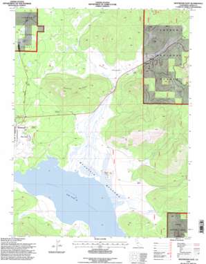
Westwood East Topo Map California
To zoom in, hover over the map of Westwood East
USGS Topo Quad 40120c8 - 1:24,000 scale
| Topo Map Name: | Westwood East |
| USGS Topo Quad ID: | 40120c8 |
| Print Size: | ca. 21 1/4" wide x 27" high |
| Southeast Coordinates: | 40.25° N latitude / 120.875° W longitude |
| Map Center Coordinates: | 40.3125° N latitude / 120.9375° W longitude |
| U.S. State: | CA |
| Filename: | o40120c8.jpg |
| Download Map JPG Image: | Westwood East topo map 1:24,000 scale |
| Map Type: | Topographic |
| Topo Series: | 7.5´ |
| Map Scale: | 1:24,000 |
| Source of Map Images: | United States Geological Survey (USGS) |
| Alternate Map Versions: |
Westwood East CA 1980, updated 1985 Download PDF Buy paper map Westwood East CA 1995, updated 1998 Download PDF Buy paper map Westwood East CA 2012 Download PDF Buy paper map Westwood East CA 2015 Download PDF Buy paper map |
| FStopo: | US Forest Service topo Westwood East is available: Download FStopo PDF Download FStopo TIF |
1:24,000 Topo Quads surrounding Westwood East
> Back to 40120a1 at 1:100,000 scale
> Back to 40120a1 at 1:250,000 scale
> Back to U.S. Topo Maps home
Westwood East topo map: Gazetteer
Westwood East: Dams
Westwood Mill Pond 1250 Dam elevation 1548m 5078′Westwood East: Flats
McKenzie Meadows elevation 1559m 5114′Mountain Meadows elevation 1540m 5052′
Westwood East: Lakes
Duck Lake elevation 1604m 5262′Rice Lake elevation 1602m 5255′
Westwood East: Populated Places
Coppervale elevation 1586m 5203′Pine Town elevation 1551m 5088′
Westwood East: Streams
Cottonwood Creek elevation 1543m 5062′Deerheart Creek elevation 1538m 5045′
Duffy Creek elevation 1545m 5068′
Goodrich Creek elevation 1538m 5045′
Mountain Meadows Creek elevation 1540m 5052′
Westwood East: Summits
Goodrich Mountain elevation 1866m 6122′Round Mountain elevation 1579m 5180′
Westwood East digital topo map on disk
Buy this Westwood East topo map showing relief, roads, GPS coordinates and other geographical features, as a high-resolution digital map file on DVD:


