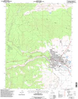
Susanville Topo Map California
To zoom in, hover over the map of Susanville
USGS Topo Quad 40120d6 - 1:24,000 scale
| Topo Map Name: | Susanville |
| USGS Topo Quad ID: | 40120d6 |
| Print Size: | ca. 21 1/4" wide x 27" high |
| Southeast Coordinates: | 40.375° N latitude / 120.625° W longitude |
| Map Center Coordinates: | 40.4375° N latitude / 120.6875° W longitude |
| U.S. State: | CA |
| Filename: | o40120d6.jpg |
| Download Map JPG Image: | Susanville topo map 1:24,000 scale |
| Map Type: | Topographic |
| Topo Series: | 7.5´ |
| Map Scale: | 1:24,000 |
| Source of Map Images: | United States Geological Survey (USGS) |
| Alternate Map Versions: |
Susanville CA 1988, updated 1989 Download PDF Buy paper map Susanville CA 1988, updated 1989 Download PDF Buy paper map Susanville CA 1995, updated 1998 Download PDF Buy paper map Susanville CA 2012 Download PDF Buy paper map Susanville CA 2015 Download PDF Buy paper map |
| FStopo: | US Forest Service topo Susanville is available: Download FStopo PDF Download FStopo TIF |
1:24,000 Topo Quads surrounding Susanville
> Back to 40120a1 at 1:100,000 scale
> Back to 40120a1 at 1:250,000 scale
> Back to U.S. Topo Maps home
Susanville topo map: Gazetteer
Susanville: Dams
Mardis Barry 1228-002 Dam elevation 1269m 4163′Mill Pond 237-006 Dam elevation 1276m 4186′
Susanville: Parks
Compton Park elevation 1286m 4219′Lasen County Fairgrounds elevation 1267m 4156′
Memorial Park elevation 1278m 4192′
Riverside Park elevation 1278m 4192′
Susan River Park elevation 1281m 4202′
Susanville: Populated Places
Susanville elevation 1276m 4186′Susanville: Post Offices
Susanville Post Office elevation 1297m 4255′Susanville: Reservoirs
Barry Reservoir elevation 1267m 4156′Susanville: Springs
Bagwell Spring elevation 1317m 4320′Cady Spring elevation 1396m 4580′
Susanville: Streams
Brockman Slough elevation 1264m 4146′Cheney Creek elevation 1379m 4524′
Jensen Slu elevation 1268m 4160′
Piute Creek elevation 1274m 4179′
Susanville: Summits
Susanville Peak elevation 1986m 6515′Susanville digital topo map on disk
Buy this Susanville topo map showing relief, roads, GPS coordinates and other geographical features, as a high-resolution digital map file on DVD:


