Shinn Mountain Topo Map California
To zoom in, hover over the map of Shinn Mountain
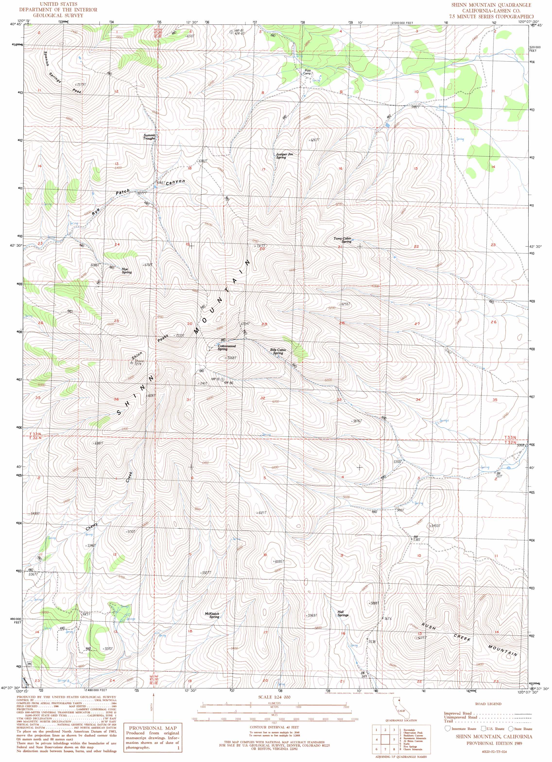
USGS Topo Quad 40120f2 - 1:24,000 scale
| Topo Map Name: | Shinn Mountain |
| USGS Topo Quad ID: | 40120f2 |
| Print Size: | ca. 21 1/4" wide x 27" high |
| Southeast Coordinates: | 40.625° N latitude / 120.125° W longitude |
| Map Center Coordinates: | 40.6875° N latitude / 120.1875° W longitude |
| U.S. State: | CA |
| Filename: | o40120f2.jpg |
| Download Map JPG Image: | Shinn Mountain topo map 1:24,000 scale |
| Map Type: | Topographic |
| Topo Series: | 7.5´ |
| Map Scale: | 1:24,000 |
| Source of Map Images: | United States Geological Survey (USGS) |
| Alternate Map Versions: |
Shinn Mountain CA 1989, updated 1989 Download PDF Buy paper map Shinn Mountain CA 2012 Download PDF Buy paper map Shinn Mountain CA 2015 Download PDF Buy paper map |
1:24,000 Topo Quads surrounding Shinn Mountain
Mcdonald Peak |
Juniper Ridge |
Dodge Reservoir |
Buckhorn Lake |
Burnt Lake |
Termo |
Ravendale |
Observation Peak |
Buckhorn Canyon |
Hole In The Ground |
West Of Snowstorm Mountain |
Snowstorm Mountain |
Shinn Mountain |
Al Shinn Canyon |
Mixie Flat |
Petes Valley |
Karlo |
Five Springs |
Cherry Mountain |
Smoke Creek Ranch |
Litchfield |
Shaffer Mountain |
Little Mud Flat |
Bull Flat |
Red Rock Canyon |
> Back to 40120e1 at 1:100,000 scale
> Back to 40120a1 at 1:250,000 scale
> Back to U.S. Topo Maps home
Shinn Mountain topo map: Gazetteer
Shinn Mountain: Springs
Bills Cabin Spring elevation 1920m 6299′Cottonwood Spring elevation 2046m 6712′
Hall Springs elevation 1736m 5695′
Juniper Jim Spring elevation 1870m 6135′
McKissick Spring elevation 1604m 5262′
Nye Spring elevation 1938m 6358′
Summit Troughs elevation 1940m 6364′
Toms Cabin Spring elevation 1868m 6128′
Shinn Mountain: Summits
Shinn Mountain elevation 2297m 7536′Shinn Peaks elevation 2158m 7080′
Spanish Springs Peak elevation 2309m 7575′
Shinn Mountain digital topo map on disk
Buy this Shinn Mountain topo map showing relief, roads, GPS coordinates and other geographical features, as a high-resolution digital map file on DVD: