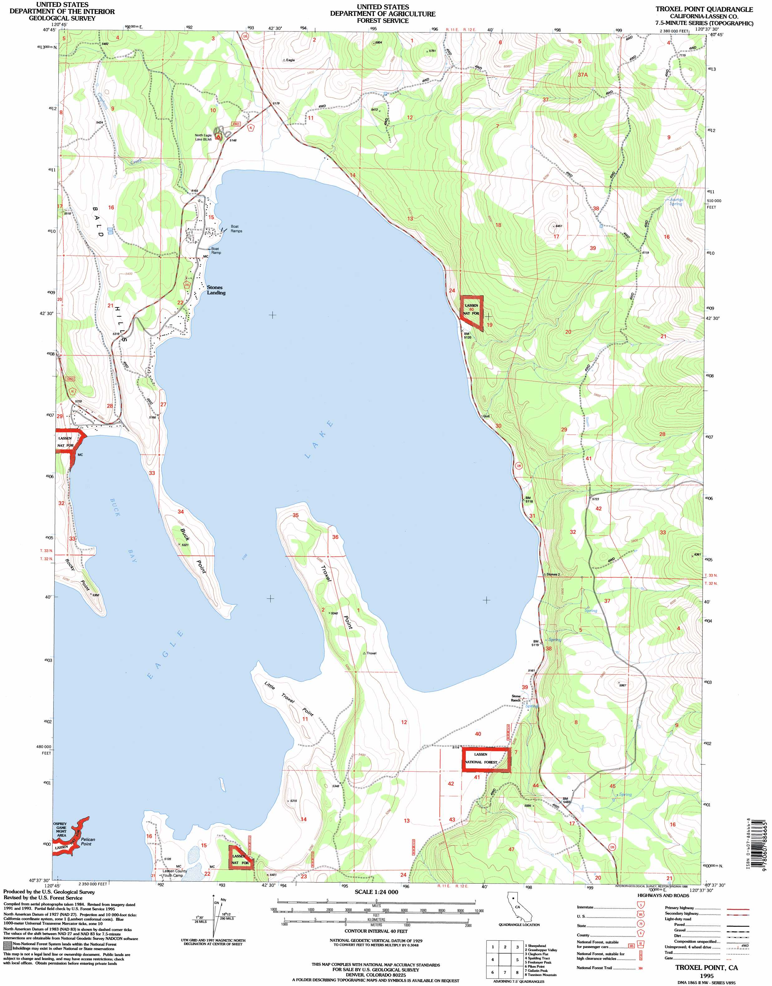
Troxel Point Topo Map California
To zoom in, hover over the map of Troxel Point
USGS Topo Quad 40120f6 - 1:24,000 scale
| Topo Map Name: | Troxel Point |
| USGS Topo Quad ID: | 40120f6 |
| Print Size: | ca. 21 1/4" wide x 27" high |
| Southeast Coordinates: | 40.625° N latitude / 120.625° W longitude |
| Map Center Coordinates: | 40.6875° N latitude / 120.6875° W longitude |
| U.S. State: | CA |
| Filename: | o40120f6.jpg |
| Download Map JPG Image: | Troxel Point topo map 1:24,000 scale |
| Map Type: | Topographic |
| Topo Series: | 7.5´ |
| Map Scale: | 1:24,000 |
| Source of Map Images: | United States Geological Survey (USGS) |
| Alternate Map Versions: |
Troxel Point CA 1989, updated 1989 Download PDF Buy paper map Troxel Point CA 1995, updated 1998 Download PDF Buy paper map Troxel Point CA 2012 Download PDF Buy paper map Troxel Point CA 2015 Download PDF Buy paper map |
| FStopo: | US Forest Service topo Troxel Point is available: Download FStopo PDF Download FStopo TIF |
1:24,000 Topo Quads surrounding Troxel Point
Silva Flat Reservoir |
Said Valley |
Whitinger Mountain |
Anderson Mountain |
Mcdonald Peak |
Bullard Lake |
Sheepshead |
Grasshopper Valley |
Cleghorn Flat |
Termo |
Champs Flat |
Spalding Tract |
Troxel Point |
Fredonyer Peak |
West Of Snowstorm Mountain |
Antelope Mountain |
Pikes Point |
Gallatin Peak |
Tunnison Mountain |
Petes Valley |
Pegleg Mountain |
Roop Mountain |
Susanville |
Johnstonville |
Litchfield |
> Back to 40120e1 at 1:100,000 scale
> Back to 40120a1 at 1:250,000 scale
> Back to U.S. Topo Maps home
Troxel Point topo map: Gazetteer
Troxel Point: Bays
Buck Bay elevation 1558m 5111′Troxel Point: Capes
Buck Point elevation 1570m 5150′Little Troxel Point elevation 1558m 5111′
Pelican Point elevation 1558m 5111′
Rocky Point elevation 1628m 5341′
Troxel Point elevation 1575m 5167′
Troxel Point: Lakes
Eagle Lake elevation 1558m 5111′Troxel Point: Populated Places
Stones Landing elevation 1565m 5134′Troxel Point: Springs
Jauriga Spring elevation 1961m 6433′Troxel Point: Streams
Cleghorn Creek elevation 1559m 5114′Troxel Point digital topo map on disk
Buy this Troxel Point topo map showing relief, roads, GPS coordinates and other geographical features, as a high-resolution digital map file on DVD: