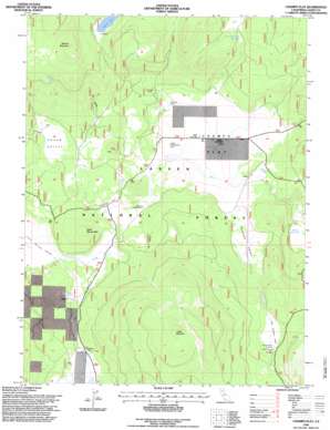
Champs Flat Topo Map California
To zoom in, hover over the map of Champs Flat
USGS Topo Quad 40120f8 - 1:24,000 scale
| Topo Map Name: | Champs Flat |
| USGS Topo Quad ID: | 40120f8 |
| Print Size: | ca. 21 1/4" wide x 27" high |
| Southeast Coordinates: | 40.625° N latitude / 120.875° W longitude |
| Map Center Coordinates: | 40.6875° N latitude / 120.9375° W longitude |
| U.S. State: | CA |
| Filename: | o40120f8.jpg |
| Download Map JPG Image: | Champs Flat topo map 1:24,000 scale |
| Map Type: | Topographic |
| Topo Series: | 7.5´ |
| Map Scale: | 1:24,000 |
| Source of Map Images: | United States Geological Survey (USGS) |
| Alternate Map Versions: |
Champs Flat CA 1983, updated 1983 Download PDF Buy paper map Champs Flat CA 1983, updated 1983 Download PDF Buy paper map Champs Flat CA 1983, updated 1985 Download PDF Buy paper map Champs Flat CA 1995, updated 1997 Download PDF Buy paper map Champs Flat CA 2012 Download PDF Buy paper map Champs Flat CA 2015 Download PDF Buy paper map |
| FStopo: | US Forest Service topo Champs Flat is available: Download FStopo PDF Download FStopo TIF |
1:24,000 Topo Quads surrounding Champs Flat
> Back to 40120e1 at 1:100,000 scale
> Back to 40120a1 at 1:250,000 scale
> Back to U.S. Topo Maps home
Champs Flat topo map: Gazetteer
Champs Flat: Flats
Burgess Flat elevation 1686m 5531′Champs Flat elevation 1678m 5505′
Champs Flat: Lakes
Ashurst Lake elevation 1926m 6318′Champs Flat: Reservoirs
Shays Hole Reservoir elevation 1843m 6046′Champs Flat: Springs
Logan Spring elevation 1693m 5554′Stanford Spring elevation 1895m 6217′
Champs Flat: Summits
Ashurst Mountain elevation 2143m 7030′Little Harvey Mountain elevation 1816m 5958′
Logan Mountain elevation 2121m 6958′
Champs Flat: Valleys
Antelope Valley elevation 1681m 5515′Little Antelope Valley elevation 1804m 5918′
Little Harvey Valley elevation 1685m 5528′
Squaw Valley elevation 1720m 5643′
Champs Flat: Wells
Fleming Well elevation 1688m 5538′Little Antelope Well elevation 1791m 5875′
McCoy Water Pit elevation 1645m 5396′
Champs Flat digital topo map on disk
Buy this Champs Flat topo map showing relief, roads, GPS coordinates and other geographical features, as a high-resolution digital map file on DVD:


