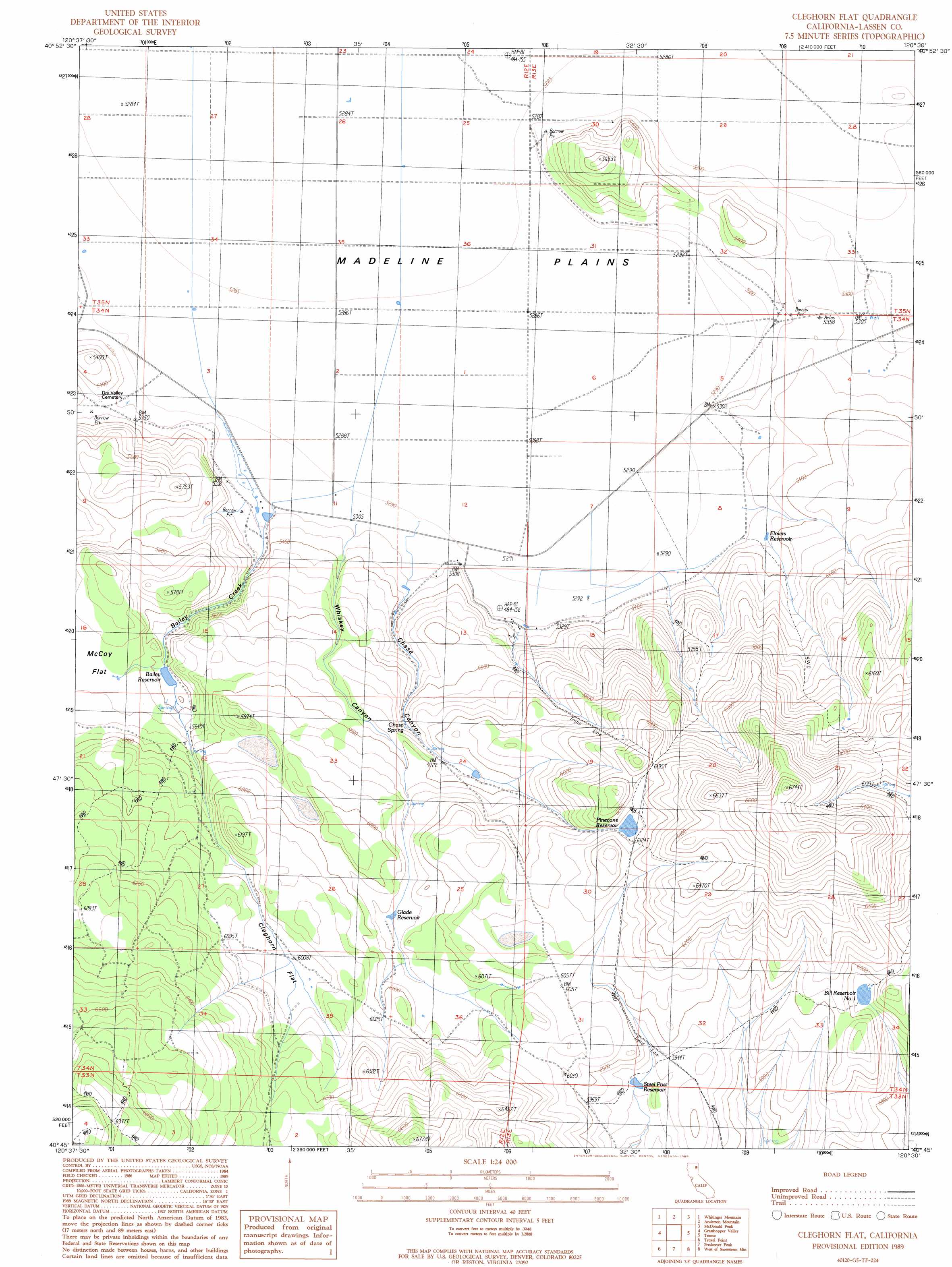
Cleghorn Flat Topo Map California
To zoom in, hover over the map of Cleghorn Flat
USGS Topo Quad 40120g5 - 1:24,000 scale
| Topo Map Name: | Cleghorn Flat |
| USGS Topo Quad ID: | 40120g5 |
| Print Size: | ca. 21 1/4" wide x 27" high |
| Southeast Coordinates: | 40.75° N latitude / 120.5° W longitude |
| Map Center Coordinates: | 40.8125° N latitude / 120.5625° W longitude |
| U.S. State: | CA |
| Filename: | o40120g5.jpg |
| Download Map JPG Image: | Cleghorn Flat topo map 1:24,000 scale |
| Map Type: | Topographic |
| Topo Series: | 7.5´ |
| Map Scale: | 1:24,000 |
| Source of Map Images: | United States Geological Survey (USGS) |
| Alternate Map Versions: |
Cleghorn Flat CA 1989, updated 1989 Download PDF Buy paper map Cleghorn Flat CA 2012 Download PDF Buy paper map Cleghorn Flat CA 2015 Download PDF Buy paper map |
1:24,000 Topo Quads surrounding Cleghorn Flat
Lane Reservoir |
Ash Valley |
Holbrook Canyon |
Madeline |
Cold Spring Mountain |
Said Valley |
Whitinger Mountain |
Anderson Mountain |
Mcdonald Peak |
Juniper Ridge |
Sheepshead |
Grasshopper Valley |
Cleghorn Flat |
Termo |
Ravendale |
Spalding Tract |
Troxel Point |
Fredonyer Peak |
West Of Snowstorm Mountain |
Snowstorm Mountain |
Pikes Point |
Gallatin Peak |
Tunnison Mountain |
Petes Valley |
Karlo |
> Back to 40120e1 at 1:100,000 scale
> Back to 40120a1 at 1:250,000 scale
> Back to U.S. Topo Maps home
Cleghorn Flat topo map: Gazetteer
Cleghorn Flat: Flats
Cleghorn Flat elevation 1837m 6026′McCoy Flat elevation 1729m 5672′
Cleghorn Flat: Reservoirs
Bailey Reservoir elevation 1699m 5574′Bill Reservoir Number 1 elevation 1813m 5948′
Elmers Reservoir elevation 1633m 5357′
Glade Reservoir elevation 1803m 5915′
Pinecone Reservoir elevation 1865m 6118′
Steel Post Reservoir elevation 1797m 5895′
Cleghorn Flat: Springs
Chase Spring elevation 1723m 5652′Cleghorn Flat: Streams
Bailey Creek elevation 1613m 5291′Cleghorn Flat: Valleys
Chase Canyon elevation 1622m 5321′Whiskey Canyon elevation 1623m 5324′
Cleghorn Flat digital topo map on disk
Buy this Cleghorn Flat topo map showing relief, roads, GPS coordinates and other geographical features, as a high-resolution digital map file on DVD: