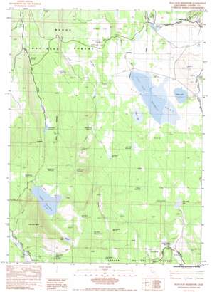
Silva Flat Reservoir Topo Map California
To zoom in, hover over the map of Silva Flat Reservoir
USGS Topo Quad 40120h8 - 1:24,000 scale
| Topo Map Name: | Silva Flat Reservoir |
| USGS Topo Quad ID: | 40120h8 |
| Print Size: | ca. 21 1/4" wide x 27" high |
| Southeast Coordinates: | 40.875° N latitude / 120.875° W longitude |
| Map Center Coordinates: | 40.9375° N latitude / 120.9375° W longitude |
| U.S. State: | CA |
| Filename: | o40120h8.jpg |
| Download Map JPG Image: | Silva Flat Reservoir topo map 1:24,000 scale |
| Map Type: | Topographic |
| Topo Series: | 7.5´ |
| Map Scale: | 1:24,000 |
| Source of Map Images: | United States Geological Survey (USGS) |
| Alternate Map Versions: |
Silva Flat Reservoir CA 1983, updated 1983 Download PDF Buy paper map Silva Flat Reservoir CA 1993, updated 1996 Download PDF Buy paper map Silva Flat Reservoir CA 2012 Download PDF Buy paper map Silva Flat Reservoir CA 2015 Download PDF Buy paper map |
| FStopo: | US Forest Service topo Silva Flat Reservoir is available: Download FStopo PDF Download FStopo TIF |
1:24,000 Topo Quads surrounding Silva Flat Reservoir
> Back to 40120e1 at 1:100,000 scale
> Back to 40120a1 at 1:250,000 scale
> Back to U.S. Topo Maps home
Silva Flat Reservoir topo map: Gazetteer
Silva Flat Reservoir: Dams
Coyote Flat 233 Dam elevation 1433m 4701′Silva Flat 232 Dam elevation 1712m 5616′
Spaulding 1246 Dam elevation 1638m 5374′
Silva Flat Reservoir: Flats
Antelope Flat elevation 1698m 5570′Silva Flat elevation 1712m 5616′
Silva Flat Reservoir: Lakes
Buckhorn Waterhole elevation 1635m 5364′Cow Lake elevation 1488m 4881′
Dillion Lake elevation 1712m 5616′
Juniper Lake elevation 1709m 5606′
Snider Waterhole elevation 1723m 5652′
Van Sickle Lake elevation 1706m 5597′
Silva Flat Reservoir: Populated Places
Hayden Hill elevation 1742m 5715′Silva Flat Reservoir: Reservoirs
Bald Ridges Reservoir elevation 1649m 5410′Corral Valley Reservoir elevation 1690m 5544′
Coyote Reservoir elevation 1433m 4701′
Deadhorse Reservoir elevation 1492m 4895′
Dobe Flat Reservoir elevation 1674m 5492′
Indian Reservoir elevation 1662m 5452′
Little Coyote Reservoir elevation 1507m 4944′
Log Cabin Reservoir Number 1 elevation 1543m 5062′
Log Cabin Reservoir Number 2 elevation 1483m 4865′
Lost Valley Reservoir elevation 1563m 5127′
Silva Flat Reservoir elevation 1712m 5616′
Spaulding Reservoir elevation 1450m 4757′
Tire Body Reservoir elevation 1466m 4809′
Silva Flat Reservoir: Ridges
Bald Ridges elevation 1683m 5521′Silva Flat Reservoir: Springs
Bunselmeier Spring elevation 1701m 5580′Mud Spring elevation 1680m 5511′
Ollie Rivis Spring elevation 1560m 5118′
Summit Spring elevation 1617m 5305′
Silva Flat Reservoir: Summits
Indian Mountain elevation 1698m 5570′Lost Valley Mountain elevation 1752m 5748′
Negro Mountain elevation 1694m 5557′
Summers Hill elevation 1810m 5938′
Silva Flat Reservoir: Valleys
Corral Hollow elevation 1697m 5567′Corral Valley elevation 1665m 5462′
Coyote Canyon elevation 1337m 4386′
Sheep Valley elevation 1437m 4714′
Silva Flat Reservoir digital topo map on disk
Buy this Silva Flat Reservoir topo map showing relief, roads, GPS coordinates and other geographical features, as a high-resolution digital map file on DVD:


