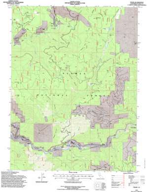
Twain Topo Map California
To zoom in, hover over the map of Twain
USGS Topo Quad 40121a1 - 1:24,000 scale
| Topo Map Name: | Twain |
| USGS Topo Quad ID: | 40121a1 |
| Print Size: | ca. 21 1/4" wide x 27" high |
| Southeast Coordinates: | 40° N latitude / 121° W longitude |
| Map Center Coordinates: | 40.0625° N latitude / 121.0625° W longitude |
| U.S. State: | CA |
| Filename: | o40121a1.jpg |
| Download Map JPG Image: | Twain topo map 1:24,000 scale |
| Map Type: | Topographic |
| Topo Series: | 7.5´ |
| Map Scale: | 1:24,000 |
| Source of Map Images: | United States Geological Survey (USGS) |
| Alternate Map Versions: |
Twain CA 1980, updated 1980 Download PDF Buy paper map Twain CA 1980, updated 1985 Download PDF Buy paper map Twain CA 1994, updated 1997 Download PDF Buy paper map Twain CA 2012 Download PDF Buy paper map Twain CA 2015 Download PDF Buy paper map |
| FStopo: | US Forest Service topo Twain is available: Download FStopo PDF Download FStopo TIF |
1:24,000 Topo Quads surrounding Twain
> Back to 40121a1 at 1:100,000 scale
> Back to 40120a1 at 1:250,000 scale
> Back to U.S. Topo Maps home
Twain topo map: Gazetteer
Twain: Bars
China Bar elevation 978m 3208′Meeker Bar elevation 996m 3267′
Twain: Flats
Hallsted Flat elevation 853m 2798′Onion Flat elevation 1684m 5524′
Twain: Mines
Comeback Mine elevation 1616m 5301′Dutch Hill Mine elevation 1420m 4658′
Dutch Hill Tunnel elevation 1370m 4494′
Glazier Mine elevation 1129m 3704′
Hazard Mine elevation 1340m 4396′
Logan Tunnel elevation 1403m 4603′
Lucky Chance Mine elevation 1084m 3556′
Mary Cameron Mine elevation 1116m 3661′
Providence Hill Mine elevation 1308m 4291′
Sunnyside Mine elevation 1099m 3605′
Swiss Mine elevation 1282m 4206′
Virgilia Mine elevation 844m 2769′
White Horse Mine elevation 1578m 5177′
Twain: Pillars
Eagle Rock elevation 1906m 6253′Twain: Populated Places
Grays Flat elevation 899m 2949′Hot Springs elevation 858m 2814′
Seneca elevation 1105m 3625′
Twain elevation 871m 2857′
Virgilia elevation 848m 2782′
Twain: Springs
Cold Spring elevation 1585m 5200′Twain: Streams
Bear Creek elevation 1220m 4002′Berry Creek elevation 835m 2739′
Clear Creek elevation 975m 3198′
Cow Creek elevation 1585m 5200′
Davis Creek elevation 1129m 3704′
Dutch Creek elevation 862m 2828′
East Branch Soda Creek elevation 942m 3090′
Mill Creek elevation 839m 2752′
Muggins Creek elevation 1000m 3280′
Rush Creek elevation 827m 2713′
West Branch Soda Creek elevation 947m 3106′
York Creek elevation 836m 2742′
Twain: Summits
Cold Spring Hill elevation 1906m 6253′Rush Creek Hill elevation 1930m 6332′
Twain: Tunnels
Tunnel Number 26 elevation 872m 2860′Twain: Valleys
Barker Gulch elevation 1262m 4140′Bullfrog Ravine elevation 1397m 4583′
Dark Ravine elevation 1501m 4924′
Digger Ravine elevation 890m 2919′
Hambly Ravine elevation 1009m 3310′
Hot Springs Ravine elevation 890m 2919′
Johnson Ravine elevation 1169m 3835′
Kingsbury Ravine elevation 964m 3162′
Kirkham Ravine elevation 1080m 3543′
Long Valley elevation 1552m 5091′
Marion Ravine elevation 1067m 3500′
Middle Ravine elevation 1117m 3664′
Rich Gulch elevation 910m 2985′
Schneider Ravine elevation 1278m 4192′
Twelvemile Ravine elevation 823m 2700′
Twain digital topo map on disk
Buy this Twain topo map showing relief, roads, GPS coordinates and other geographical features, as a high-resolution digital map file on DVD:


