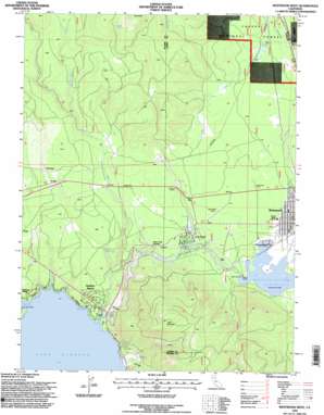
Westwood West Topo Map California
To zoom in, hover over the map of Westwood West
USGS Topo Quad 40121c1 - 1:24,000 scale
| Topo Map Name: | Westwood West |
| USGS Topo Quad ID: | 40121c1 |
| Print Size: | ca. 21 1/4" wide x 27" high |
| Southeast Coordinates: | 40.25° N latitude / 121° W longitude |
| Map Center Coordinates: | 40.3125° N latitude / 121.0625° W longitude |
| U.S. State: | CA |
| Filename: | o40121c1.jpg |
| Download Map JPG Image: | Westwood West topo map 1:24,000 scale |
| Map Type: | Topographic |
| Topo Series: | 7.5´ |
| Map Scale: | 1:24,000 |
| Source of Map Images: | United States Geological Survey (USGS) |
| Alternate Map Versions: |
Westwood West CA 1980, updated 1985 Download PDF Buy paper map Westwood West CA 1995, updated 1998 Download PDF Buy paper map Westwood West CA 2012 Download PDF Buy paper map Westwood West CA 2015 Download PDF Buy paper map |
| FStopo: | US Forest Service topo Westwood West is available: Download FStopo PDF Download FStopo TIF |
1:24,000 Topo Quads surrounding Westwood West
> Back to 40121a1 at 1:100,000 scale
> Back to 40120a1 at 1:250,000 scale
> Back to U.S. Topo Maps home
Westwood West topo map: Gazetteer
Westwood West: Airports
Westwood Airport elevation 1556m 5104′Westwood West: Bays
Big Cove elevation 1373m 4504′Westwood West: Dams
Indian Ole 97-113 Dam elevation 1539m 5049′Indian Ole Dam elevation 1539m 5049′
Westwood West: Levees
Kelly elevation 1486m 4875′Westwood West: Parks
Clear Creek Park elevation 1514m 4967′Westwood West: Populated Places
Clear Creek elevation 1515m 4970′Hamilton Branch elevation 1410m 4625′
Robbers Creek elevation 1623m 5324′
Westwood elevation 1563m 5127′
Westwood West: Post Offices
Westwood Post Office elevation 1550m 5085′Westwood West: Reservoirs
Mountain Meadows Reservoir elevation 1539m 5049′Westwood West: Springs
Big Springs elevation 1378m 4520′Brush Spring elevation 1738m 5702′
Schumacher Spring elevation 1463m 4799′
Tamarack Springs elevation 1610m 5282′
Walker Spring elevation 1531m 5022′
Westwood West: Streams
Dry Creek elevation 1499m 4917′Hamilton Branch elevation 1373m 4504′
Jennie Creek elevation 1539m 5049′
Robbers Creek elevation 1538m 5045′
Rock Creek elevation 1408m 4619′
Westwood West: Summits
Brush Hill elevation 1862m 6108′Little Dyer Mountain elevation 1939m 6361′
Westwood West digital topo map on disk
Buy this Westwood West topo map showing relief, roads, GPS coordinates and other geographical features, as a high-resolution digital map file on DVD:


