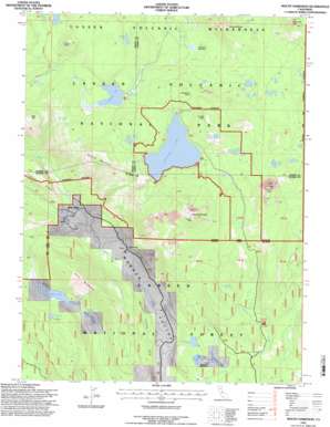
Mount Harkness Topo Map California
To zoom in, hover over the map of Mount Harkness
USGS Topo Quad 40121d3 - 1:24,000 scale
| Topo Map Name: | Mount Harkness |
| USGS Topo Quad ID: | 40121d3 |
| Print Size: | ca. 21 1/4" wide x 27" high |
| Southeast Coordinates: | 40.375° N latitude / 121.25° W longitude |
| Map Center Coordinates: | 40.4375° N latitude / 121.3125° W longitude |
| U.S. State: | CA |
| Filename: | o40121d3.jpg |
| Download Map JPG Image: | Mount Harkness topo map 1:24,000 scale |
| Map Type: | Topographic |
| Topo Series: | 7.5´ |
| Map Scale: | 1:24,000 |
| Source of Map Images: | United States Geological Survey (USGS) |
| Alternate Map Versions: |
Mt. Harkness CA 1985, updated 1985 Download PDF Buy paper map Mount Harkness CA 1995, updated 1997 Download PDF Buy paper map Mount Harkness CA 2012 Download PDF Buy paper map Mount Harkness CA 2015 Download PDF Buy paper map |
| FStopo: | US Forest Service topo Mount Harkness is available: Download FStopo PDF Download FStopo TIF |
1:24,000 Topo Quads surrounding Mount Harkness
> Back to 40121a1 at 1:100,000 scale
> Back to 40120a1 at 1:250,000 scale
> Back to U.S. Topo Maps home
Mount Harkness topo map: Gazetteer
Mount Harkness: Capes
Inspiration Point elevation 2194m 7198′Mount Harkness: Cliffs
Crystal Cliffs elevation 2221m 7286′Warner Valley Rim elevation 1584m 5196′
Mount Harkness: Flats
Cameron Meadow elevation 1959m 6427′Mount Harkness: Lakes
Blue Lake elevation 1640m 5380′Bluff Lake elevation 2105m 6906′
Crater Pool elevation 2157m 7076′
Crystal Lake elevation 2199m 7214′
Domingo Lake elevation 1773m 5816′
East Lake elevation 2165m 7103′
Fleischmann Lake elevation 1640m 5380′
Glen Lake elevation 2120m 6955′
Hidden Lake elevation 2031m 6663′
Horseshoe Lake elevation 1994m 6541′
Indian Lake elevation 2129m 6984′
Island Lake elevation 2167m 7109′
Jakey Lake elevation 2118m 6948′
Juniper Lake elevation 2055m 6742′
Swan Lake elevation 2018m 6620′
Willow Lake elevation 1653m 5423′
Mount Harkness: Springs
Benner Spring elevation 1815m 5954′Mount Harkness: Streams
Hot Springs Creek elevation 1593m 5226′Kings Creek elevation 1593m 5226′
Mount Harkness: Summits
Bonte Peak elevation 2344m 7690′Crater Butte elevation 2211m 7253′
Kelly Mountain elevation 2088m 6850′
Mount Harkness elevation 2452m 8044′
Mount Hoffman elevation 2381m 7811′
Pilot Mountain elevation 2183m 7162′
Saddle Mountain elevation 2325m 7627′
Mount Harkness: Swamps
Cameron Meadows elevation 1627m 5337′Mount Harkness digital topo map on disk
Buy this Mount Harkness topo map showing relief, roads, GPS coordinates and other geographical features, as a high-resolution digital map file on DVD:


