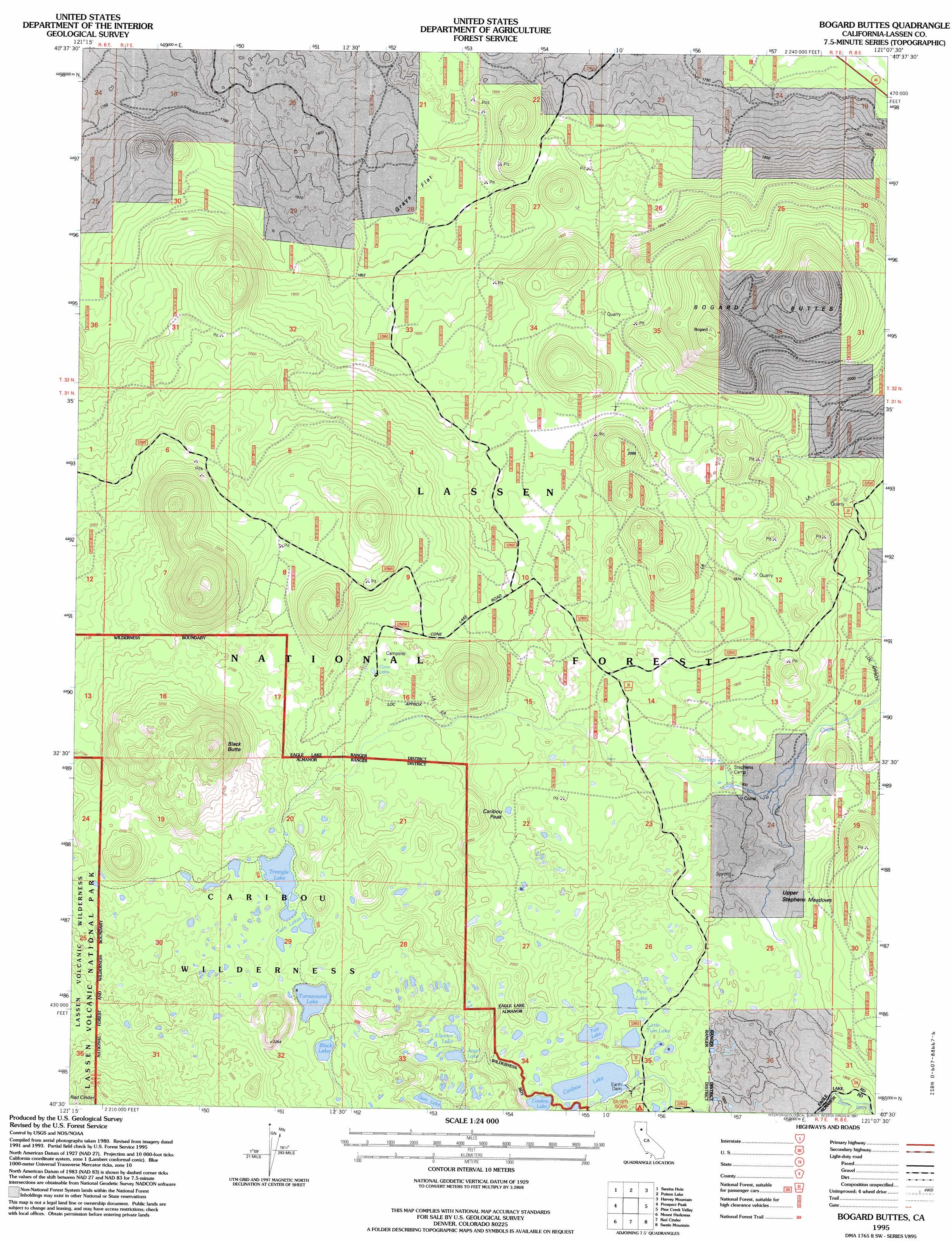
Bogard Buttes Topo Map California
To zoom in, hover over the map of Bogard Buttes
USGS Topo Quad 40121e2 - 1:24,000 scale
| Topo Map Name: | Bogard Buttes |
| USGS Topo Quad ID: | 40121e2 |
| Print Size: | ca. 21 1/4" wide x 27" high |
| Southeast Coordinates: | 40.5° N latitude / 121.125° W longitude |
| Map Center Coordinates: | 40.5625° N latitude / 121.1875° W longitude |
| U.S. State: | CA |
| Filename: | o40121e2.jpg |
| Download Map JPG Image: | Bogard Buttes topo map 1:24,000 scale |
| Map Type: | Topographic |
| Topo Series: | 7.5´ |
| Map Scale: | 1:24,000 |
| Source of Map Images: | United States Geological Survey (USGS) |
| Alternate Map Versions: |
Bogard Buttes CA 1983, updated 1983 Download PDF Buy paper map Bogard Buttes CA 1995, updated 1997 Download PDF Buy paper map Bogard Buttes CA 2012 Download PDF Buy paper map Bogard Buttes CA 2015 Download PDF Buy paper map |
| FStopo: | US Forest Service topo Bogard Buttes is available: Download FStopo PDF Download FStopo TIF |
1:24,000 Topo Quads surrounding Bogard Buttes
Murken Bench |
Jellico |
Corders Reservoir |
Straylor Lake |
Bullard Lake |
Old Station |
Swains Hole |
Poison Lake |
Harvey Mountain |
Champs Flat |
West Prospect Peak |
Prospect Peak |
Bogard Buttes |
Pine Creek Valley |
Antelope Mountain |
Reading Peak |
Mount Harkness |
Red Cinder |
Swain Mountain |
Pegleg Mountain |
Childs Meadows |
Stover Mountain |
Chester |
Westwood West |
Westwood East |
> Back to 40121e1 at 1:100,000 scale
> Back to 40120a1 at 1:250,000 scale
> Back to U.S. Topo Maps home
Bogard Buttes topo map: Gazetteer
Bogard Buttes: Dams
Caribou Lake 234 Dam elevation 2000m 6561′Bogard Buttes: Flats
Grays Flat elevation 1810m 5938′Bogard Buttes: Lakes
Black Lake elevation 2148m 7047′Caribou Lake elevation 2003m 6571′
Cone Lake elevation 2059m 6755′
Cowboy Lake elevation 2014m 6607′
Eleanor Lake elevation 2110m 6922′
Gem Lake elevation 2128m 6981′
Jewel Lake elevation 2109m 6919′
Little Tule Lake elevation 1980m 6496′
Pine Lake elevation 1976m 6482′
Tule Lake elevation 1989m 6525′
Turnaround Lake elevation 2149m 7050′
Twin Lakes elevation 2155m 7070′
Bogard Buttes: Reservoirs
Triangle Lake elevation 2155m 7070′Bogard Buttes: Summits
Black Butte elevation 2435m 7988′Bogard Buttes elevation 2282m 7486′
Caribou Peak elevation 2104m 6902′
Bogard Buttes: Swamps
Cooper Swamp elevation 1905m 6250′Upper Stephens Meadows elevation 1919m 6295′
Bogard Buttes digital topo map on disk
Buy this Bogard Buttes topo map showing relief, roads, GPS coordinates and other geographical features, as a high-resolution digital map file on DVD: