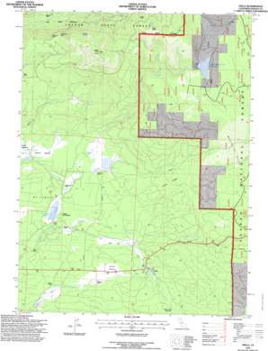
Viola Topo Map California
To zoom in, hover over the map of Viola
USGS Topo Quad 40121e6 - 1:24,000 scale
| Topo Map Name: | Viola |
| USGS Topo Quad ID: | 40121e6 |
| Print Size: | ca. 21 1/4" wide x 27" high |
| Southeast Coordinates: | 40.5° N latitude / 121.625° W longitude |
| Map Center Coordinates: | 40.5625° N latitude / 121.6875° W longitude |
| U.S. State: | CA |
| Filename: | o40121e6.jpg |
| Download Map JPG Image: | Viola topo map 1:24,000 scale |
| Map Type: | Topographic |
| Topo Series: | 7.5´ |
| Map Scale: | 1:24,000 |
| Source of Map Images: | United States Geological Survey (USGS) |
| Alternate Map Versions: |
Viola CA 1986, updated 1986 Download PDF Buy paper map Viola CA 1995, updated 1997 Download PDF Buy paper map Viola CA 2012 Download PDF Buy paper map Viola CA 2015 Download PDF Buy paper map |
| FStopo: | US Forest Service topo Viola is available: Download FStopo PDF Download FStopo TIF |
1:24,000 Topo Quads surrounding Viola
> Back to 40121e1 at 1:100,000 scale
> Back to 40120a1 at 1:250,000 scale
> Back to U.S. Topo Maps home
Viola topo map: Gazetteer
Viola: Cliffs
Palisade Cliff elevation 1543m 5062′Viola: Dams
McCumber 97-094 Dam elevation 1238m 4061′North Battle Creek 97-096 Dam elevation 1697m 5567′
Viola: Flats
Bailey Creek Meadows elevation 1410m 4625′Deer Flat elevation 1289m 4229′
McCumber Flat elevation 1253m 4110′
Scharsch Meadows elevation 1300m 4265′
Thatchers Meadows elevation 1257m 4124′
Viola: Lakes
Cirque Lake elevation 1864m 6115′Viola: Pillars
Castle Rock elevation 1782m 5846′Mushroom Rock elevation 1615m 5298′
Viola: Populated Places
Bateman Place elevation 1291m 4235′Beal Place elevation 1383m 4537′
Eastman Place elevation 1234m 4048′
Viola elevation 1353m 4438′
Viola: Post Offices
Viola Post Office (historical) elevation 1353m 4438′Viola: Reservoirs
McCumber Reservoir elevation 1238m 4061′North Battle Creek Reservoir elevation 1697m 5567′
Viola: Ridges
Rooster Comb elevation 1704m 5590′Viola: Springs
Manzanita Spring elevation 1254m 4114′Mountain Home Spring elevation 1245m 4084′
Viola: Streams
Bridges Creek elevation 1256m 4120′Bullhock Creek elevation 1660m 5446′
Deer Creek elevation 1228m 4028′
Manzanita Creek elevation 1240m 4068′
Viola: Summits
Buck Butte elevation 1969m 6459′Latour Butte elevation 2043m 6702′
Viola: Woods
Cherry Thicket elevation 1376m 4514′Viola digital topo map on disk
Buy this Viola topo map showing relief, roads, GPS coordinates and other geographical features, as a high-resolution digital map file on DVD:


