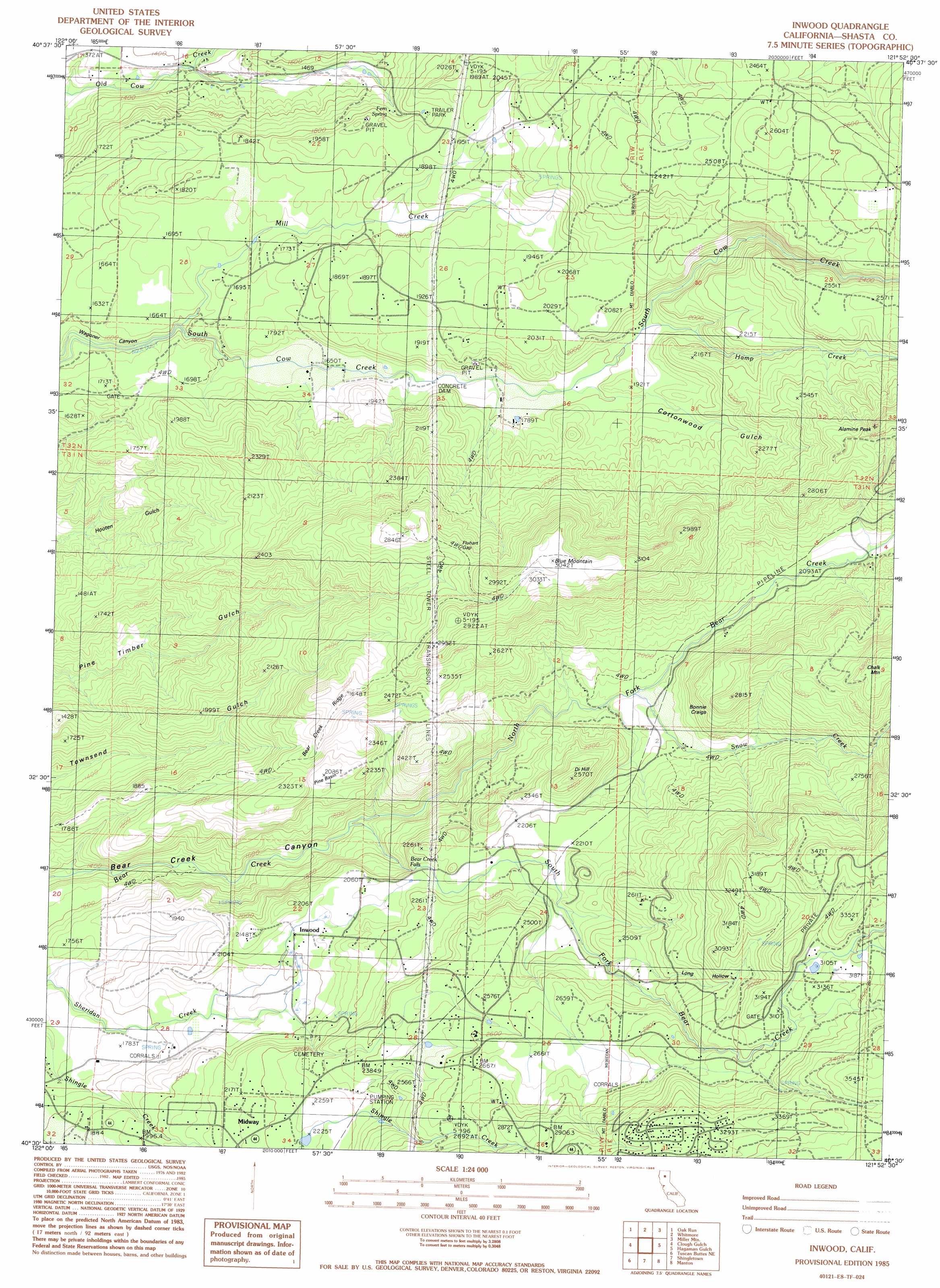
Inwood Topo Map California
To zoom in, hover over the map of Inwood
USGS Topo Quad 40121e8 - 1:24,000 scale
| Topo Map Name: | Inwood |
| USGS Topo Quad ID: | 40121e8 |
| Print Size: | ca. 21 1/4" wide x 27" high |
| Southeast Coordinates: | 40.5° N latitude / 121.875° W longitude |
| Map Center Coordinates: | 40.5625° N latitude / 121.9375° W longitude |
| U.S. State: | CA |
| Filename: | o40121e8.jpg |
| Download Map JPG Image: | Inwood topo map 1:24,000 scale |
| Map Type: | Topographic |
| Topo Series: | 7.5´ |
| Map Scale: | 1:24,000 |
| Source of Map Images: | United States Geological Survey (USGS) |
| Alternate Map Versions: |
Inwood CA 1985, updated 1986 Download PDF Buy paper map Inwood CA 2012 Download PDF Buy paper map Inwood CA 2015 Download PDF Buy paper map |
1:24,000 Topo Quads surrounding Inwood
Minnesota Mountain |
Devils Rock |
Montgomery Creek |
Hatchet Mountain Pass |
Burney Mountain West |
Bella Vista |
Oak Run |
Whitmore |
Miller Mountain |
Jacks Backbone |
Palo Cedro |
Clough Gulch |
Inwood |
Hagaman Gulch |
Viola |
Balls Ferry |
Tuscan Buttes Ne |
Shingletown |
Manton |
Grays Peak |
Bend |
Dales |
Inskip Hill |
Finley Butte |
Lyonsville |
> Back to 40121e1 at 1:100,000 scale
> Back to 40120a1 at 1:250,000 scale
> Back to U.S. Topo Maps home
Inwood topo map: Gazetteer
Inwood: Basins
Fluhart Basin elevation 548m 1797′Pine Basin elevation 645m 2116′
Inwood: Cliffs
Bonnie Craigs elevation 724m 2375′Inwood: Falls
Bear Creek Falls elevation 625m 2050′Inwood: Gaps
Fluhart Gap elevation 815m 2673′Inwood: Populated Places
Inwood elevation 634m 2080′Midway elevation 674m 2211′
Redwoods elevation 611m 2004′
Inwood: Ridges
Bear Creek Ridge elevation 798m 2618′Inwood: Springs
Fern Spring elevation 543m 1781′Inwood: Streams
Hamp Creek elevation 558m 1830′Mill Creek elevation 475m 1558′
North Fork Bear Creek elevation 487m 1597′
Snow Creek elevation 586m 1922′
South Fork Bear Creek elevation 485m 1591′
Inwood: Summits
Alamine Peak elevation 843m 2765′Blue Mountain elevation 937m 3074′
Di Hill elevation 776m 2545′
Inwood: Valleys
Cottonwood Gulch elevation 541m 1774′Long Hollow elevation 743m 2437′
Inwood digital topo map on disk
Buy this Inwood topo map showing relief, roads, GPS coordinates and other geographical features, as a high-resolution digital map file on DVD: