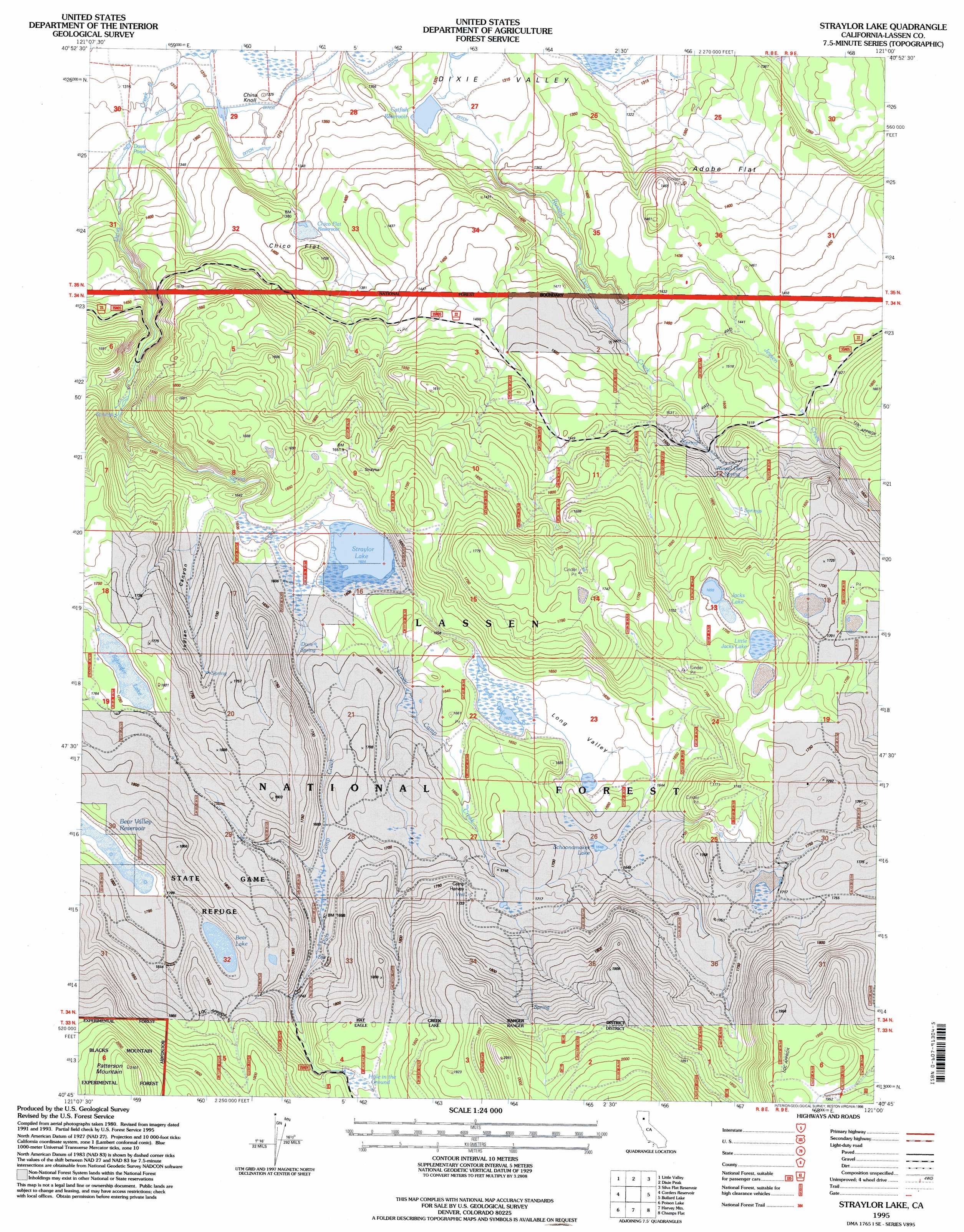
Straylor Lake Topo Map California
To zoom in, hover over the map of Straylor Lake
USGS Topo Quad 40121g1 - 1:24,000 scale
| Topo Map Name: | Straylor Lake |
| USGS Topo Quad ID: | 40121g1 |
| Print Size: | ca. 21 1/4" wide x 27" high |
| Southeast Coordinates: | 40.75° N latitude / 121° W longitude |
| Map Center Coordinates: | 40.8125° N latitude / 121.0625° W longitude |
| U.S. State: | CA |
| Filename: | o40121g1.jpg |
| Download Map JPG Image: | Straylor Lake topo map 1:24,000 scale |
| Map Type: | Topographic |
| Topo Series: | 7.5´ |
| Map Scale: | 1:24,000 |
| Source of Map Images: | United States Geological Survey (USGS) |
| Alternate Map Versions: |
Straylor Lake CA 1983, updated 1983 Download PDF Buy paper map Straylor Lake CA 1995, updated 1998 Download PDF Buy paper map Straylor Lake CA 2012 Download PDF Buy paper map Straylor Lake CA 2015 Download PDF Buy paper map |
| FStopo: | US Forest Service topo Straylor Lake is available: Download FStopo PDF Download FStopo TIF |
1:24,000 Topo Quads surrounding Straylor Lake
Pittville |
Bieber |
Hog Valley |
Letterbox Hill |
Lane Reservoir |
Coble Mountain |
Little Valley |
Dixie Peak |
Silva Flat Reservoir |
Said Valley |
Jellico |
Corders Reservoir |
Straylor Lake |
Bullard Lake |
Sheepshead |
Swains Hole |
Poison Lake |
Harvey Mountain |
Champs Flat |
Spalding Tract |
Prospect Peak |
Bogard Buttes |
Pine Creek Valley |
Antelope Mountain |
Pikes Point |
> Back to 40121e1 at 1:100,000 scale
> Back to 40120a1 at 1:250,000 scale
> Back to U.S. Topo Maps home
Straylor Lake topo map: Gazetteer
Straylor Lake: Flats
Adobe Flat elevation 1382m 4534′Chico Flat elevation 1381m 4530′
Straylor Lake: Lakes
Bear Lake elevation 1806m 5925′Jacks Lake elevation 1700m 5577′
Little Jacks Lake elevation 1704m 5590′
Long Lake elevation 1628m 5341′
Schoonamaker Lake elevation 1650m 5413′
Schrode Lake elevation 1749m 5738′
Straylor Lake elevation 1605m 5265′
Straylor Lake: Reservoirs
Catfish Reservoir elevation 1315m 4314′Chico Flat Reservoir elevation 1381m 4530′
Davis Pond elevation 1332m 4370′
Double Take Reservoir elevation 1704m 5590′
Straylor Lake: Springs
Dixie Spring elevation 1626m 5334′Russell Dairy Spring elevation 1546m 5072′
Straylor Lake: Streams
Puls Camp Creek elevation 1606m 5269′Russell Dairy Creek elevation 1315m 4314′
Straylor Lake: Summits
China Knoll elevation 1322m 4337′Patterson Mountain elevation 2097m 6879′
Straylor Lake: Swamps
Hole in the Ground elevation 1812m 5944′Straylor Lake: Valleys
Long Valley elevation 1631m 5351′Straylor Lake digital topo map on disk
Buy this Straylor Lake topo map showing relief, roads, GPS coordinates and other geographical features, as a high-resolution digital map file on DVD: