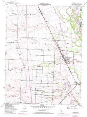
Gerber Topo Map California
To zoom in, hover over the map of Gerber
USGS Topo Quad 40122a2 - 1:24,000 scale
| Topo Map Name: | Gerber |
| USGS Topo Quad ID: | 40122a2 |
| Print Size: | ca. 21 1/4" wide x 27" high |
| Southeast Coordinates: | 40° N latitude / 122.125° W longitude |
| Map Center Coordinates: | 40.0625° N latitude / 122.1875° W longitude |
| U.S. State: | CA |
| Filename: | o40122a2.jpg |
| Download Map JPG Image: | Gerber topo map 1:24,000 scale |
| Map Type: | Topographic |
| Topo Series: | 7.5´ |
| Map Scale: | 1:24,000 |
| Source of Map Images: | United States Geological Survey (USGS) |
| Alternate Map Versions: |
Gerber CA 1950, updated 1962 Download PDF Buy paper map Gerber CA 1950, updated 1971 Download PDF Buy paper map Gerber CA 1950, updated 1977 Download PDF Buy paper map Gerber CA 1951 Download PDF Buy paper map Gerber CA 2012 Download PDF Buy paper map Gerber CA 2015 Download PDF Buy paper map |
1:24,000 Topo Quads surrounding Gerber
> Back to 40122a1 at 1:100,000 scale
> Back to 40122a1 at 1:250,000 scale
> Back to U.S. Topo Maps home
Gerber topo map: Gazetteer
Gerber: Bars
Sacramento Bar elevation 68m 223′Gerber: Canals
Corning Canal elevation 94m 308′Gerber: Islands
Mooney Island elevation 72m 236′Todd Island elevation 71m 232′
Gerber: Populated Places
El Camino elevation 79m 259′Gerber elevation 70m 229′
Kiska elevation 74m 242′
Las Flores elevation 77m 252′
Proberta elevation 77m 252′
Rawson elevation 86m 282′
Gerber: Streams
Butler Slough elevation 68m 223′Coyote Creek elevation 66m 216′
Rodeo Creek elevation 66m 216′
Truckee Creek elevation 68m 223′
Willow Creek elevation 82m 269′
Gerber digital topo map on disk
Buy this Gerber topo map showing relief, roads, GPS coordinates and other geographical features, as a high-resolution digital map file on DVD:


