Tuscan Buttes Ne Topo Map California
To zoom in, hover over the map of Tuscan Buttes Ne
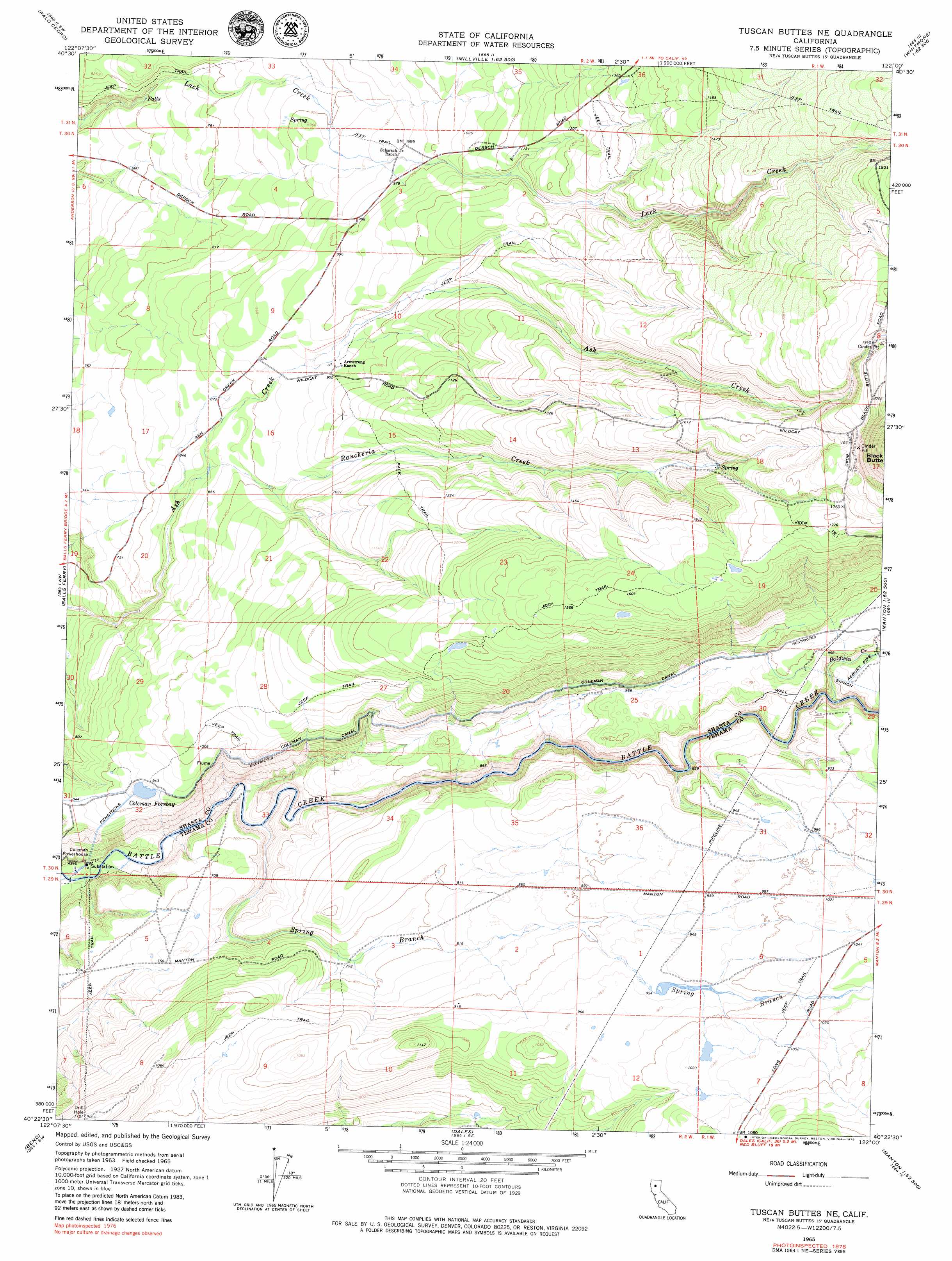
USGS Topo Quad 40122d1 - 1:24,000 scale
| Topo Map Name: | Tuscan Buttes Ne |
| USGS Topo Quad ID: | 40122d1 |
| Print Size: | ca. 21 1/4" wide x 27" high |
| Southeast Coordinates: | 40.375° N latitude / 122° W longitude |
| Map Center Coordinates: | 40.4375° N latitude / 122.0625° W longitude |
| U.S. State: | CA |
| Filename: | o40122d1.jpg |
| Download Map JPG Image: | Tuscan Buttes Ne topo map 1:24,000 scale |
| Map Type: | Topographic |
| Topo Series: | 7.5´ |
| Map Scale: | 1:24,000 |
| Source of Map Images: | United States Geological Survey (USGS) |
| Alternate Map Versions: |
Tuscan Buttes NE CA 1965, updated 1966 Download PDF Buy paper map Tuscan Buttes NE CA 1965, updated 1979 Download PDF Buy paper map Tuscan Buttes NE CA 2012 Download PDF Buy paper map Tuscan Buttes NE CA 2015 Download PDF Buy paper map |
1:24,000 Topo Quads surrounding Tuscan Buttes Ne
Project City |
Bella Vista |
Oak Run |
Whitmore |
Miller Mountain |
Enterprise |
Palo Cedro |
Clough Gulch |
Inwood |
Hagaman Gulch |
Cottonwood |
Balls Ferry |
Tuscan Buttes Ne |
Shingletown |
Manton |
Hooker |
Bend |
Dales |
Inskip Hill |
Finley Butte |
Red Bluff West |
Red Bluff East |
Tuscan Springs |
Dewitt Peak |
Panther Spring |
> Back to 40122a1 at 1:100,000 scale
> Back to 40122a1 at 1:250,000 scale
> Back to U.S. Topo Maps home
Tuscan Buttes Ne topo map: Gazetteer
Tuscan Buttes Ne: Canals
Coleman Canal elevation 297m 974′Tuscan Buttes Ne: Dams
Coleman Forebay 97-087 Dam elevation 287m 941′Tuscan Buttes Ne: Reservoirs
Coleman Forebay elevation 287m 941′Tuscan Buttes Ne: Streams
Baldwin Creek elevation 247m 810′Morgan Creek elevation 221m 725′
Rancheria Creek elevation 257m 843′
Spring Branch elevation 161m 528′
Tuscan Buttes Ne digital topo map on disk
Buy this Tuscan Buttes Ne topo map showing relief, roads, GPS coordinates and other geographical features, as a high-resolution digital map file on DVD: