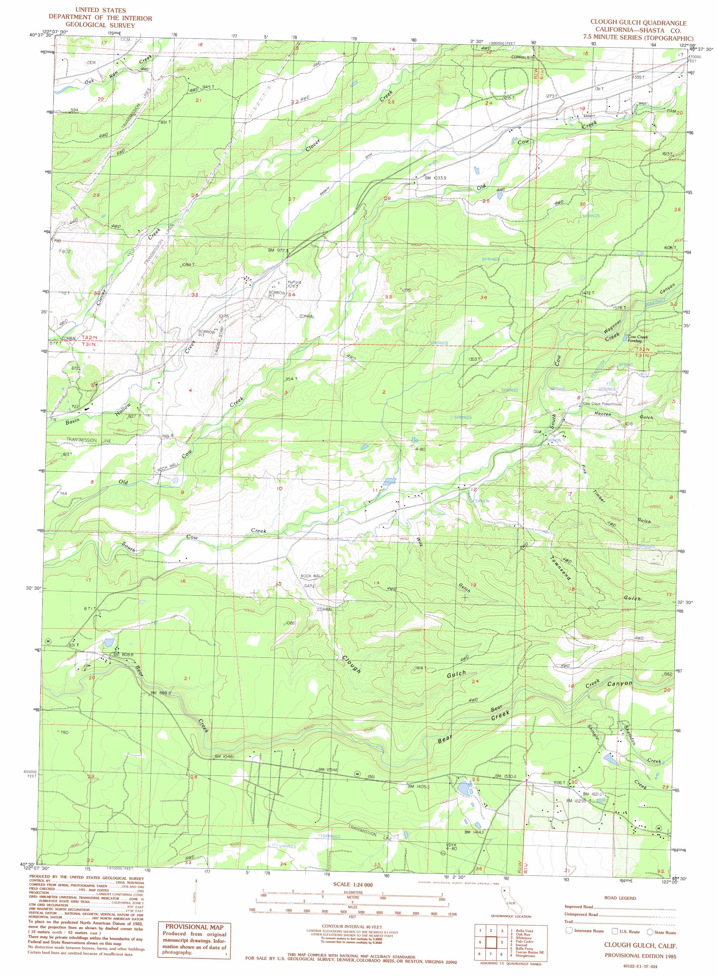
Clough Gulch Topo Map California
To zoom in, hover over the map of Clough Gulch
USGS Topo Quad 40122e1 - 1:24,000 scale
| Topo Map Name: | Clough Gulch |
| USGS Topo Quad ID: | 40122e1 |
| Print Size: | ca. 21 1/4" wide x 27" high |
| Southeast Coordinates: | 40.5° N latitude / 122° W longitude |
| Map Center Coordinates: | 40.5625° N latitude / 122.0625° W longitude |
| U.S. State: | CA |
| Filename: | o40122e1.jpg |
| Download Map JPG Image: | Clough Gulch topo map 1:24,000 scale |
| Map Type: | Topographic |
| Topo Series: | 7.5´ |
| Map Scale: | 1:24,000 |
| Source of Map Images: | United States Geological Survey (USGS) |
| Alternate Map Versions: |
Clough Gulch CA 1985, updated 1986 Download PDF Buy paper map Clough Gulch CA 2012 Download PDF Buy paper map Clough Gulch CA 2015 Download PDF Buy paper map |
1:24,000 Topo Quads surrounding Clough Gulch
O'Brien |
Minnesota Mountain |
Devils Rock |
Montgomery Creek |
Hatchet Mountain Pass |
Project City |
Bella Vista |
Oak Run |
Whitmore |
Miller Mountain |
Enterprise |
Palo Cedro |
Clough Gulch |
Inwood |
Hagaman Gulch |
Cottonwood |
Balls Ferry |
Tuscan Buttes Ne |
Shingletown |
Manton |
Hooker |
Bend |
Dales |
Inskip Hill |
Finley Butte |
> Back to 40122e1 at 1:100,000 scale
> Back to 40122a1 at 1:250,000 scale
> Back to U.S. Topo Maps home
Clough Gulch topo map: Gazetteer
Clough Gulch: Lakes
Cow Creek Forebay elevation 474m 1555′Clough Gulch: Populated Places
Ellis (historical) elevation 221m 725′Pawnee elevation 352m 1154′
Smith elevation 318m 1043′
Wagoner elevation 232m 761′
Clough Gulch: Streams
Sheridan Creek elevation 365m 1197′Shingle Creek elevation 363m 1190′
Clough Gulch: Valleys
Bear Creek Canyon elevation 241m 790′Clough Gulch elevation 203m 666′
Hooten Gulch elevation 245m 803′
Pine Timber Gulch elevation 236m 774′
Townsend Gulch elevation 236m 774′
Wagoner Canyon elevation 244m 800′
Wilk Gulch elevation 227m 744′
Clough Gulch digital topo map on disk
Buy this Clough Gulch topo map showing relief, roads, GPS coordinates and other geographical features, as a high-resolution digital map file on DVD: