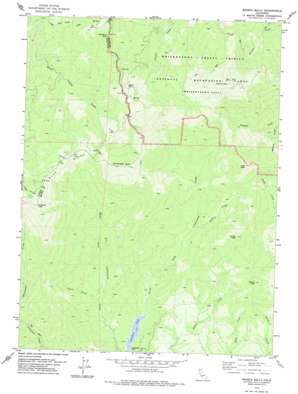
Shasta Bally Topo Map California
To zoom in, hover over the map of Shasta Bally
USGS Topo Quad 40122e6 - 1:24,000 scale
| Topo Map Name: | Shasta Bally |
| USGS Topo Quad ID: | 40122e6 |
| Print Size: | ca. 21 1/4" wide x 27" high |
| Southeast Coordinates: | 40.5° N latitude / 122.625° W longitude |
| Map Center Coordinates: | 40.5625° N latitude / 122.6875° W longitude |
| U.S. State: | CA |
| Filename: | o40122e6.jpg |
| Download Map JPG Image: | Shasta Bally topo map 1:24,000 scale |
| Map Type: | Topographic |
| Topo Series: | 7.5´ |
| Map Scale: | 1:24,000 |
| Source of Map Images: | United States Geological Survey (USGS) |
| Alternate Map Versions: |
Shasta Bally CA 1978, updated 1978 Download PDF Buy paper map Shasta Bally CA 2012 Download PDF Buy paper map Shasta Bally CA 2015 Download PDF Buy paper map |
1:24,000 Topo Quads surrounding Shasta Bally
> Back to 40122e1 at 1:100,000 scale
> Back to 40122a1 at 1:250,000 scale
> Back to U.S. Topo Maps home
Shasta Bally topo map: Gazetteer
Shasta Bally: Dams
Musselbeck Dam elevation 612m 2007′Shasta Bally: Parks
Coggins Park elevation 1243m 4078′Shasta Bally: Reservoirs
Rainbow Lake elevation 612m 2007′Shasta Bally: Ridges
Blue Ridge elevation 1655m 5429′Shasta Bally: Streams
Gimblin Creek elevation 825m 2706′Shasta Bally: Summits
Buckhorn Bally elevation 1520m 4986′Ducket Peak elevation 1392m 4566′
Little Bally elevation 1640m 5380′
Paradise Peak elevation 1920m 6299′
Rector Peak elevation 1068m 3503′
Shasta Bally elevation 1882m 6174′
Shoemaker Bally elevation 1807m 5928′
Shasta Bally: Valleys
Beartrap Gulch elevation 941m 3087′Taylor Gulch elevation 712m 2335′
Shasta Bally digital topo map on disk
Buy this Shasta Bally topo map showing relief, roads, GPS coordinates and other geographical features, as a high-resolution digital map file on DVD:


