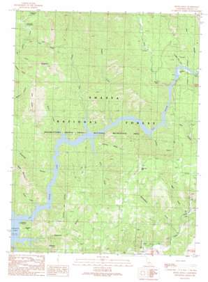
Devils Rock Topo Map California
To zoom in, hover over the map of Devils Rock
USGS Topo Quad 40122g1 - 1:24,000 scale
| Topo Map Name: | Devils Rock |
| USGS Topo Quad ID: | 40122g1 |
| Print Size: | ca. 21 1/4" wide x 27" high |
| Southeast Coordinates: | 40.75° N latitude / 122° W longitude |
| Map Center Coordinates: | 40.8125° N latitude / 122.0625° W longitude |
| U.S. State: | CA |
| Filename: | o40122g1.jpg |
| Download Map JPG Image: | Devils Rock topo map 1:24,000 scale |
| Map Type: | Topographic |
| Topo Series: | 7.5´ |
| Map Scale: | 1:24,000 |
| Source of Map Images: | United States Geological Survey (USGS) |
| Alternate Map Versions: |
Devils Rock CA 1990, updated 1990 Download PDF Buy paper map Devils Rock CA 1998, updated 2003 Download PDF Buy paper map Devils Rock CA 2012 Download PDF Buy paper map Devils Rock CA 2015 Download PDF Buy paper map |
| FStopo: | US Forest Service topo Devils Rock is available: Download FStopo PDF Download FStopo TIF |
1:24,000 Topo Quads surrounding Devils Rock
> Back to 40122e1 at 1:100,000 scale
> Back to 40122a1 at 1:250,000 scale
> Back to U.S. Topo Maps home
Devils Rock topo map: Gazetteer
Devils Rock: Falls
Potem Falls elevation 359m 1177′Devils Rock: Flats
Arbuckle Flat elevation 416m 1364′Fenders Flat elevation 326m 1069′
Devils Rock: Pillars
Devils Rock elevation 986m 3234′Devils Rock: Ridges
Croxford Ridge elevation 550m 1804′Devils Rock: Springs
Alder Spring elevation 670m 2198′Devils Rock: Streams
Bars Creek elevation 362m 1187′Brock Creek elevation 325m 1066′
Cedar Creek elevation 380m 1246′
Flat Creek elevation 325m 1066′
Low Pass Creek elevation 379m 1243′
Potem Creek elevation 325m 1066′
Ripgut Creek elevation 325m 1066′
Stein Creek elevation 325m 1066′
Devils Rock: Summits
Chirpchatter Mountain elevation 597m 1958′Gray Rocks elevation 837m 2746′
Sage Hen Hill elevation 746m 2447′
Sugarloaf elevation 621m 2037′
Devils Rock: Valleys
Bear Canyon elevation 325m 1066′Bear Gulch elevation 425m 1394′
Browns Canyon elevation 325m 1066′
Constant Flow Gulch elevation 326m 1069′
Cow Canyon elevation 328m 1076′
McCandless Gulch elevation 418m 1371′
Roberts Canyon elevation 331m 1085′
Sugarpine Canyon elevation 325m 1066′
Susanville Canyon elevation 329m 1079′
Devils Rock digital topo map on disk
Buy this Devils Rock topo map showing relief, roads, GPS coordinates and other geographical features, as a high-resolution digital map file on DVD:


