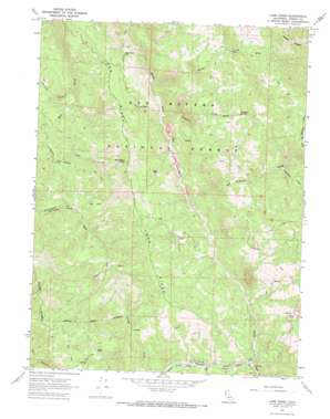
Long Ridge Topo Map California
To zoom in, hover over the map of Long Ridge
USGS Topo Quad 40123a3 - 1:24,000 scale
| Topo Map Name: | Long Ridge |
| USGS Topo Quad ID: | 40123a3 |
| Print Size: | ca. 21 1/4" wide x 27" high |
| Southeast Coordinates: | 40° N latitude / 123.25° W longitude |
| Map Center Coordinates: | 40.0625° N latitude / 123.3125° W longitude |
| U.S. State: | CA |
| Filename: | o40123a3.jpg |
| Download Map JPG Image: | Long Ridge topo map 1:24,000 scale |
| Map Type: | Topographic |
| Topo Series: | 7.5´ |
| Map Scale: | 1:24,000 |
| Source of Map Images: | United States Geological Survey (USGS) |
| Alternate Map Versions: |
Long Ridge CA 1967, updated 1969 Download PDF Buy paper map Long Ridge CA 1997, updated 2001 Download PDF Buy paper map Long Ridge CA 2012 Download PDF Buy paper map Long Ridge CA 2015 Download PDF Buy paper map |
| FStopo: | US Forest Service topo Long Ridge is available: Download FStopo PDF Download FStopo TIF |
1:24,000 Topo Quads surrounding Long Ridge
> Back to 40123a1 at 1:100,000 scale
> Back to 40122a1 at 1:250,000 scale
> Back to U.S. Topo Maps home
Long Ridge topo map: Gazetteer
Long Ridge: Populated Places
Bob Hoaglin Place elevation 695m 2280′Nielson Place elevation 782m 2565′
Willie Hoaglin Place elevation 672m 2204′
Long Ridge: Ridges
Long Ridge elevation 1046m 3431′Long Ridge: Springs
Climbing Spring elevation 1047m 3435′Schoolhouse Spring elevation 996m 3267′
Long Ridge: Streams
Cottonwood Creek elevation 692m 2270′Gypsy Creek elevation 671m 2201′
Hoaglin Creek elevation 632m 2073′
Hulls Creek elevation 390m 1279′
Lightfoot Creek elevation 518m 1699′
Little Red Mountain Creek elevation 824m 2703′
Littlefield Creek elevation 653m 2142′
Red Mountain Creek elevation 456m 1496′
Rock Creek elevation 530m 1738′
Willow Creek elevation 543m 1781′
Long Ridge: Trails
Ben Duncan Mailbox Trail elevation 774m 2539′Hoaglin Tom Duncan Trail elevation 788m 2585′
Long Ridge digital topo map on disk
Buy this Long Ridge topo map showing relief, roads, GPS coordinates and other geographical features, as a high-resolution digital map file on DVD:


