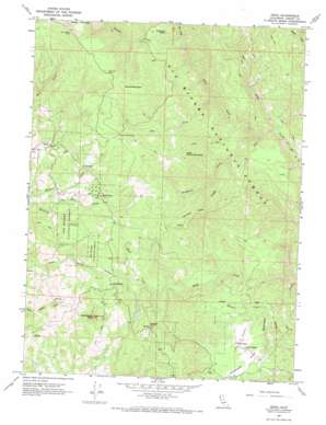
Zenia Topo Map California
To zoom in, hover over the map of Zenia
USGS Topo Quad 40123b4 - 1:24,000 scale
| Topo Map Name: | Zenia |
| USGS Topo Quad ID: | 40123b4 |
| Print Size: | ca. 21 1/4" wide x 27" high |
| Southeast Coordinates: | 40.125° N latitude / 123.375° W longitude |
| Map Center Coordinates: | 40.1875° N latitude / 123.4375° W longitude |
| U.S. State: | CA |
| Filename: | o40123b4.jpg |
| Download Map JPG Image: | Zenia topo map 1:24,000 scale |
| Map Type: | Topographic |
| Topo Series: | 7.5´ |
| Map Scale: | 1:24,000 |
| Source of Map Images: | United States Geological Survey (USGS) |
| Alternate Map Versions: |
Zenia CA 1967, updated 1969 Download PDF Buy paper map Zenia CA 1997, updated 2001 Download PDF Buy paper map Zenia CA 2012 Download PDF Buy paper map Zenia CA 2015 Download PDF Buy paper map |
| FStopo: | US Forest Service topo Zenia is available: Download FStopo PDF Download FStopo TIF |
1:24,000 Topo Quads surrounding Zenia
> Back to 40123a1 at 1:100,000 scale
> Back to 40122a1 at 1:250,000 scale
> Back to U.S. Topo Maps home
Zenia topo map: Gazetteer
Zenia: Airports
Hell'er High Water Airport elevation 760m 2493′Kettenpom Trinity County Landing Strip elevation 761m 2496′
Zenia: Lakes
Bollman Lake elevation 934m 3064′French Lake elevation 1037m 3402′
Zenia: Pillars
Panther Rock elevation 1011m 3316′Zenia: Populated Places
Kettenpom elevation 1053m 3454′Zenia elevation 905m 2969′
Zenia: Reservoirs
Bear Lake (historical) elevation 1450m 4757′Zenia: Ridges
Double Gate Ridge elevation 1083m 3553′Zenia: Springs
Atkinson Spring elevation 760m 2493′Bear Spring elevation 1475m 4839′
Bear Wallow Spring elevation 1463m 4799′
Zenia: Streams
Bar Creek elevation 816m 2677′Bluff Creek elevation 621m 2037′
Bradburn Creek elevation 668m 2191′
East Fork North Fork Eel River elevation 647m 2122′
Panther Creek elevation 816m 2677′
Salt Creek elevation 694m 2276′
West Fork North Fork Eel River elevation 647m 2122′
Wilson Creek elevation 703m 2306′
Yew Wood Creek elevation 611m 2004′
Zenia: Summits
Kettenpom Peak elevation 1248m 4094′Little Round Mountain elevation 1255m 4117′
Robbers Roost elevation 911m 2988′
Round Mountain elevation 1503m 4931′
Zenia: Valleys
Kettenpom Valley elevation 719m 2358′Zenia digital topo map on disk
Buy this Zenia topo map showing relief, roads, GPS coordinates and other geographical features, as a high-resolution digital map file on DVD:


