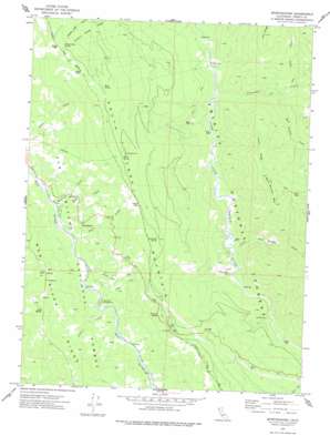
Sportshaven Topo Map California
To zoom in, hover over the map of Sportshaven
USGS Topo Quad 40123d4 - 1:24,000 scale
| Topo Map Name: | Sportshaven |
| USGS Topo Quad ID: | 40123d4 |
| Print Size: | ca. 21 1/4" wide x 27" high |
| Southeast Coordinates: | 40.375° N latitude / 123.375° W longitude |
| Map Center Coordinates: | 40.4375° N latitude / 123.4375° W longitude |
| U.S. State: | CA |
| Filename: | o40123d4.jpg |
| Download Map JPG Image: | Sportshaven topo map 1:24,000 scale |
| Map Type: | Topographic |
| Topo Series: | 7.5´ |
| Map Scale: | 1:24,000 |
| Source of Map Images: | United States Geological Survey (USGS) |
| Alternate Map Versions: |
Sportshaven CA 1973, updated 1977 Download PDF Buy paper map Sportshaven CA 1998, updated 2003 Download PDF Buy paper map Sportshaven CA 2012 Download PDF Buy paper map Sportshaven CA 2015 Download PDF Buy paper map |
| FStopo: | US Forest Service topo Sportshaven is available: Download FStopo PDF Download FStopo TIF |
1:24,000 Topo Quads surrounding Sportshaven
> Back to 40123a1 at 1:100,000 scale
> Back to 40122a1 at 1:250,000 scale
> Back to U.S. Topo Maps home
Sportshaven topo map: Gazetteer
Sportshaven: Gaps
Chris Gap elevation 1356m 4448′Lamb Gap elevation 1375m 4511′
Sportshaven: Mines
Klondike Mine elevation 615m 2017′Sportshaven: Populated Places
Graham Place elevation 561m 1840′McClellan Place elevation 537m 1761′
Miller Place elevation 687m 2253′
Norgaar (historical) elevation 588m 1929′
Sids Place elevation 1109m 3638′
Sportshaven: Ridges
Fisher Ridge elevation 1213m 3979′Jims Ridge elevation 1248m 4094′
Mad River Ridge elevation 1051m 3448′
Sportshaven: Springs
Buck Spring elevation 1577m 5173′Lemonade Spring elevation 1378m 4520′
Miller Spring elevation 1484m 4868′
Sheep Camp Spring elevation 1633m 5357′
Sportshaven: Streams
Bear Wallow Creek elevation 585m 1919′Cherry Glade Creek elevation 758m 2486′
Grace Creek elevation 778m 2552′
Jims Creek elevation 604m 1981′
Little Bear Wallow Creek elevation 551m 1807′
Maynard Creek elevation 754m 2473′
Olsen Creek elevation 757m 2483′
Plummer Creek elevation 511m 1676′
Rock Creek elevation 756m 2480′
Sportshaven: Summits
Bear Wallow Mountain elevation 1466m 4809′Norse Butte elevation 1338m 4389′
Pine Butte elevation 1325m 4347′
Sportshaven: Woods
Oak Grove elevation 1156m 3792′Sportshaven digital topo map on disk
Buy this Sportshaven topo map showing relief, roads, GPS coordinates and other geographical features, as a high-resolution digital map file on DVD:


