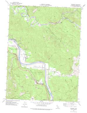
Redcrest Topo Map California
To zoom in, hover over the map of Redcrest
USGS Topo Quad 40123d8 - 1:24,000 scale
| Topo Map Name: | Redcrest |
| USGS Topo Quad ID: | 40123d8 |
| Print Size: | ca. 21 1/4" wide x 27" high |
| Southeast Coordinates: | 40.375° N latitude / 123.875° W longitude |
| Map Center Coordinates: | 40.4375° N latitude / 123.9375° W longitude |
| U.S. State: | CA |
| Filename: | o40123d8.jpg |
| Download Map JPG Image: | Redcrest topo map 1:24,000 scale |
| Map Type: | Topographic |
| Topo Series: | 7.5´ |
| Map Scale: | 1:24,000 |
| Source of Map Images: | United States Geological Survey (USGS) |
| Alternate Map Versions: |
Redcrest CA 1969, updated 1974 Download PDF Buy paper map Redcrest CA 1969, updated 1974 Download PDF Buy paper map Redcrest CA 2012 Download PDF Buy paper map Redcrest CA 2015 Download PDF Buy paper map |
1:24,000 Topo Quads surrounding Redcrest
> Back to 40123a1 at 1:100,000 scale
> Back to 40122a1 at 1:250,000 scale
> Back to U.S. Topo Maps home
Redcrest topo map: Gazetteer
Redcrest: Bends
Devils Elbow elevation 105m 344′Redcrest: Flats
Chadd Prairie elevation 232m 761′Holmes Flat elevation 44m 144′
Horse Prairie elevation 423m 1387′
Shively Flat elevation 41m 134′
Weonme Flat elevation 143m 469′
Redcrest: Parks
Grizzly Creek Redwoods State Park elevation 109m 357′Van Duzen County Park elevation 65m 213′
Redcrest: Populated Places
Englewood elevation 111m 364′Holmes elevation 47m 154′
Larabee elevation 49m 160′
Pepperwood elevation 35m 114′
Redcrest elevation 115m 377′
Riverside Park elevation 77m 252′
Shively elevation 44m 144′
Redcrest: Streams
Allen Creek elevation 36m 118′Balcom Creek elevation 43m 141′
Bear Creek elevation 26m 85′
Blue Slide Creek elevation 75m 246′
Bridge Creek elevation 45m 147′
Carson Creek elevation 47m 154′
Chadd Creek elevation 33m 108′
Chris Creek elevation 31m 101′
Darnell Creek elevation 23m 75′
Dauphiny Creek elevation 49m 160′
Grizzly Creek elevation 109m 357′
Hely Creek elevation 68m 223′
Larabee Creek elevation 44m 144′
Panther Creek elevation 26m 85′
Root Creek elevation 103m 337′
Shively Creek elevation 23m 75′
Stevens Creek elevation 120m 393′
Weber Creek elevation 33m 108′
Redcrest: Summits
Clark Mountain elevation 513m 1683′Redcrest digital topo map on disk
Buy this Redcrest topo map showing relief, roads, GPS coordinates and other geographical features, as a high-resolution digital map file on DVD:


