Owl Creek Topo Map California
To zoom in, hover over the map of Owl Creek
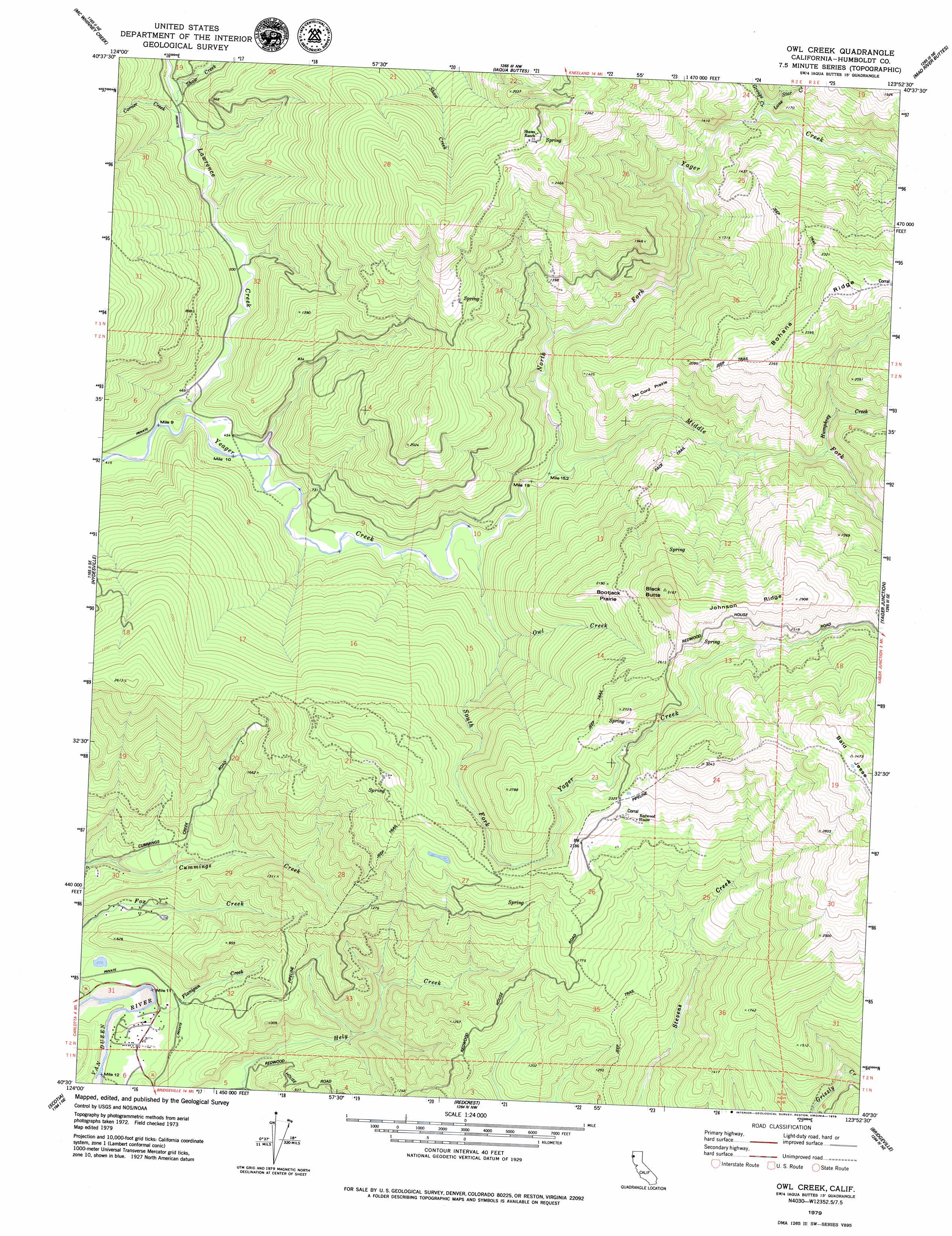
USGS Topo Quad 40123e8 - 1:24,000 scale
| Topo Map Name: | Owl Creek |
| USGS Topo Quad ID: | 40123e8 |
| Print Size: | ca. 21 1/4" wide x 27" high |
| Southeast Coordinates: | 40.5° N latitude / 123.875° W longitude |
| Map Center Coordinates: | 40.5625° N latitude / 123.9375° W longitude |
| U.S. State: | CA |
| Filename: | o40123e8.jpg |
| Download Map JPG Image: | Owl Creek topo map 1:24,000 scale |
| Map Type: | Topographic |
| Topo Series: | 7.5´ |
| Map Scale: | 1:24,000 |
| Source of Map Images: | United States Geological Survey (USGS) |
| Alternate Map Versions: |
Owl Creek CA 1979, updated 1979 Download PDF Buy paper map Owl Creek CA 2012 Download PDF Buy paper map Owl Creek CA 2015 Download PDF Buy paper map |
1:24,000 Topo Quads surrounding Owl Creek
Eureka |
Arcata South |
Korbel |
Maple Creek |
Grouse Mountain |
Fields Landing |
Mcwhinney Creek |
Iaqua Buttes |
Mad River Buttes |
Board Camp Mountain |
Fortuna |
Hydesville |
Owl Creek |
Yager Junction |
Showers Mountain |
Taylor Peak |
Scotia |
Redcrest |
Bridgeville |
Larabee Valley |
Buckeye Mountain |
Bull Creek |
Weott |
Myers Flat |
Blocksburg |
> Back to 40123e1 at 1:100,000 scale
> Back to 40122a1 at 1:250,000 scale
> Back to U.S. Topo Maps home
Owl Creek topo map: Gazetteer
Owl Creek: Flats
Bootjack Prairie elevation 628m 2060′McCord Prairie elevation 435m 1427′
Owl Creek: Ridges
Bohana Ridge elevation 732m 2401′Johnson Ridge elevation 869m 2851′
Owl Creek: Streams
Corner Creek elevation 171m 561′Digger Creek elevation 314m 1030′
Flanigan Creek elevation 50m 164′
Grouse Creek elevation 264m 866′
Humphrey Creek elevation 395m 1295′
Lawrence Creek elevation 133m 436′
Lone Star Creek elevation 280m 918′
Middle Fork Yager Creek elevation 176m 577′
North Fork Yager Creek elevation 176m 577′
Owl Creek elevation 231m 757′
Shaw Creek elevation 201m 659′
South Fork Yager Creek elevation 165m 541′
Owl Creek: Summits
Bald Jesse elevation 1050m 3444′Black Butte elevation 961m 3152′
Owl Creek digital topo map on disk
Buy this Owl Creek topo map showing relief, roads, GPS coordinates and other geographical features, as a high-resolution digital map file on DVD: